KNOXVILLE, Tenn. — UPDATE (July 30, 9:30 p.m.)After a day of storms brought flooding and wind to East Tennessee, the region could see more storms overnight into Wednesday morning. More information is available here.
--
ORIGINAL: A Flash Flood Warning was also issued for some East Tennessee counties, lasting until around 8:15 p.m. Those counties are listed below.
- Blount County
- Knox County
- McMinn County
- Monroe County
- Roane County
- Loudon County
Flash Flood Warnings that heavy rainfall could quickly cause severe flooding. It is possible for floods to develop within minutes, and people should make sure to avoid low areas where floodwater could gather.
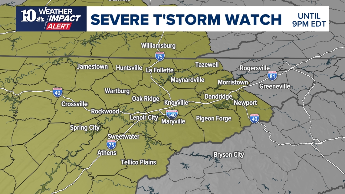
A Flood Watch is active in most of East Tennessee until 5 a.m. Wednesday, as storms moved into the region.
A Severe Thunderstorm Watch was also issued in most of East Tennessee, covering all major areas. Some areas also saw a Severe Thunderstorm Warning issued, but most warnings were allowed to expire by 7 p.m. Eastern Time.
Some Kentucky counties were also placed in the warning, including Laurel County, Wayne County, Whitley County, McCreary County, Harlan County and Pulaski County.
A warning means people should take action to stay safe such as moving indoors. A watch effectively means that the conditions are favorable for dangerous storms to develop.
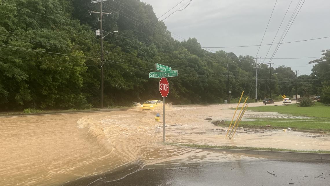
The storms brought high winds which could topple trees and knock out power for people across the area. In some areas, winds reached over 60 mph. Flooding was reported on Papermill Road, near the McKay's book store while some people also reported hail falling in areas of East Tennessee. Trees were also reported to have fallen in many areas of Knoxville, as well as flooding reports in different parts of the city.
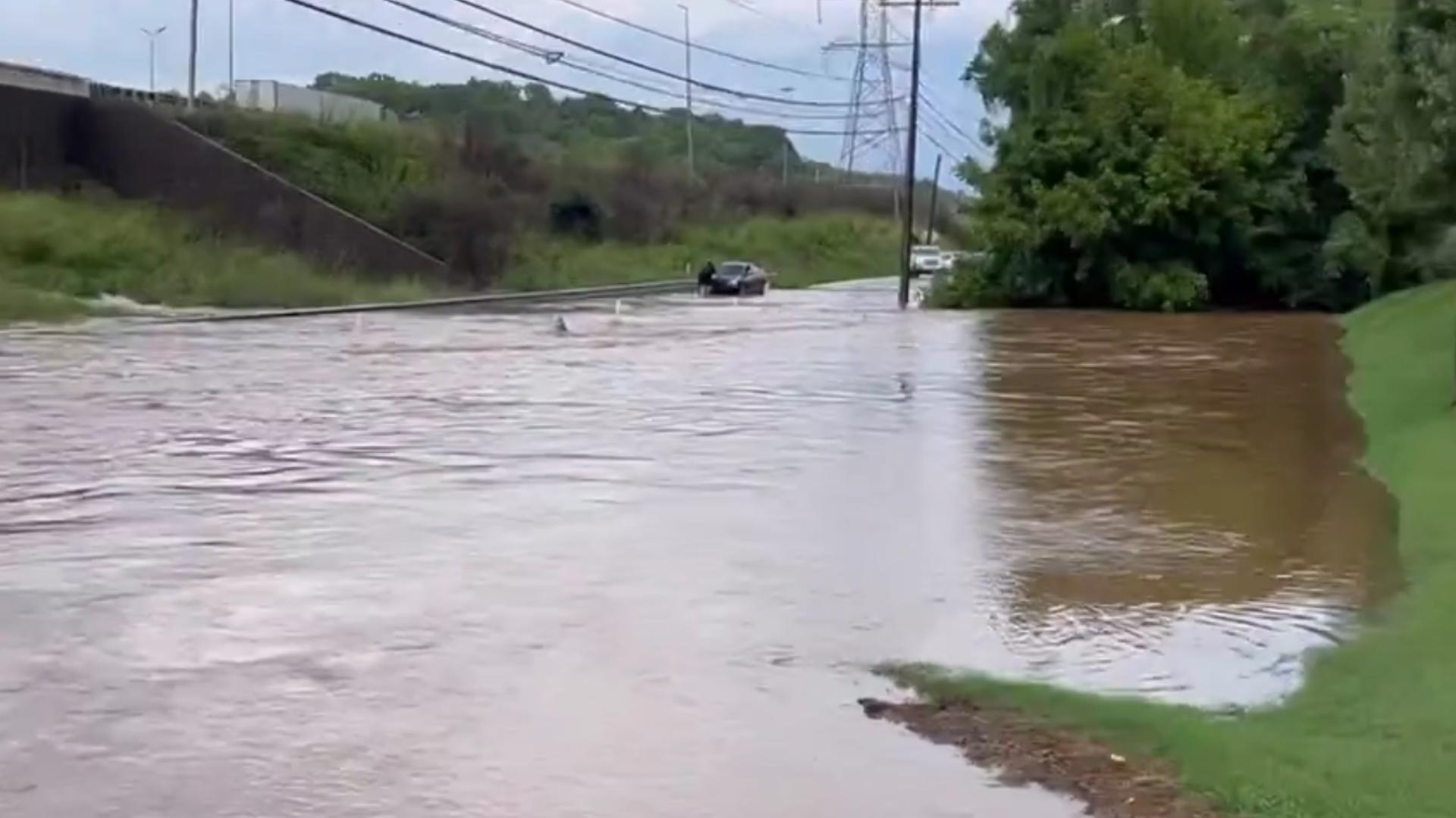
The Knoxville Fire Department said it also had to pull a person out of a car that drove into floodwaters on Fifth Avenue. They said the person was not hurt.

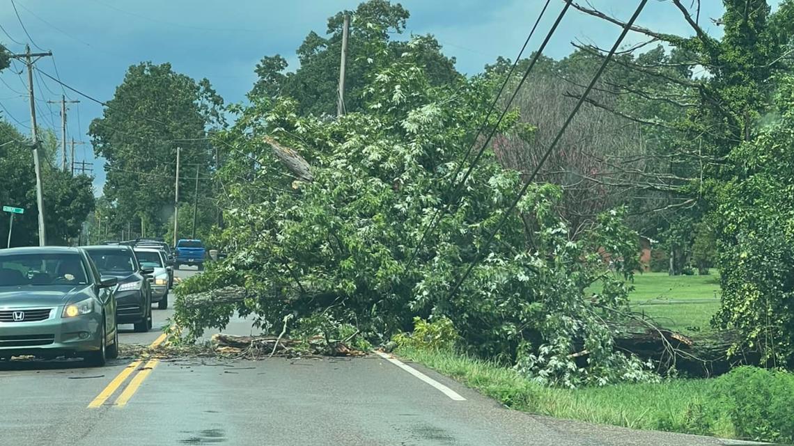
Damaging winds could also cause trees to fall or power outages. Recent storms already saturated the region's soil, increasing the possibility of trees falling down. Chances are very low for an isolated tornado, but it is not entirely impossible for the southern Kentucky region or the northern plateau.
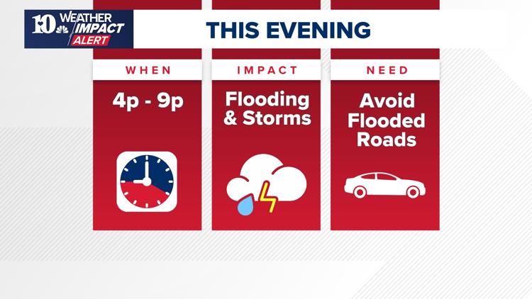
When will the weather impact me most?
The storms are expected to last until around 9 p.m., with flooding possible. People should make sure to avoid driving on flooded roads. The storms could also bring damaging winds of up to 58 mph, and hail is possible.
If thunder sounds, people should make sure to move inside to stay safe!


What's the impact?
Isolated thunderstorms could bring lightning, gusty winds and heavy rain. When thunder roars, head indoors!
Localized flooding is a concern. Flash flooding can happen very fast and impact areas with small creeks and streams, as well as urban areas and streets that have poor drainage.
People should use extreme caution on the roads and make sure never to drive through floodwaters.
At around 4:46 p.m., the Tennessee Department of Transportation said Tazewell Pike was closed in north Knox County after a single-vehicle crash. It closed both directions of the road near Carter Road, TDOT said. Flooding was also reported on I-275 near Heiskell Avenue, in North Knoxville. Flooding was also spotted on TDOT cameras on I-640 West, near the exit to I-75.

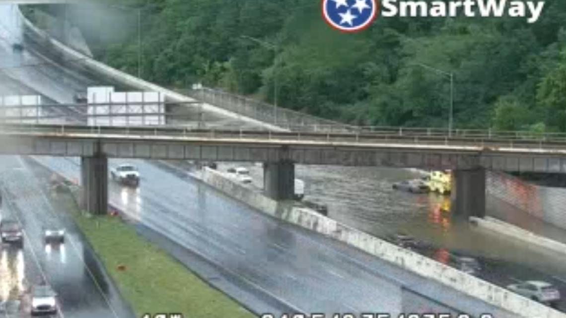
A disabled vehicle also blocked the I-640 Eastbound entry ramp, as well as the right shoulder. Rain also pooled on Papermill Road near McKay's bookstore, effectively blocking traffic.
The Maryville Police Department also said power lines fell on East Lamar Alexander Parkway, between Buchanan Road and John Helton Road. That road was closed at around 5:10 p.m.
In Oak Ridge, a fallen tree and vehicle crash blocked a lane of traffic on Melton Lake Drive near Rivers Run Boulevard.
The Knoxville Police Department said people could report flooded roads in the city by calling 865-215-4010.
People should also make sure to charge their devices, in case power goes out at home. Thousands of customers across East Tennessee lost power as the storm moved through the region, according to several utility companies.
The City of Alcoa said a total of 10,099 customers were without power at around 5 p.m. after two substations went down. KUB also said at around 5:50 p.m. around 9,030 customers lost power in Knoxville and crews were working to fix the issue. The Appalachian Electric Cooperative also said around 1,863 customers were without power in Jefferson County.