
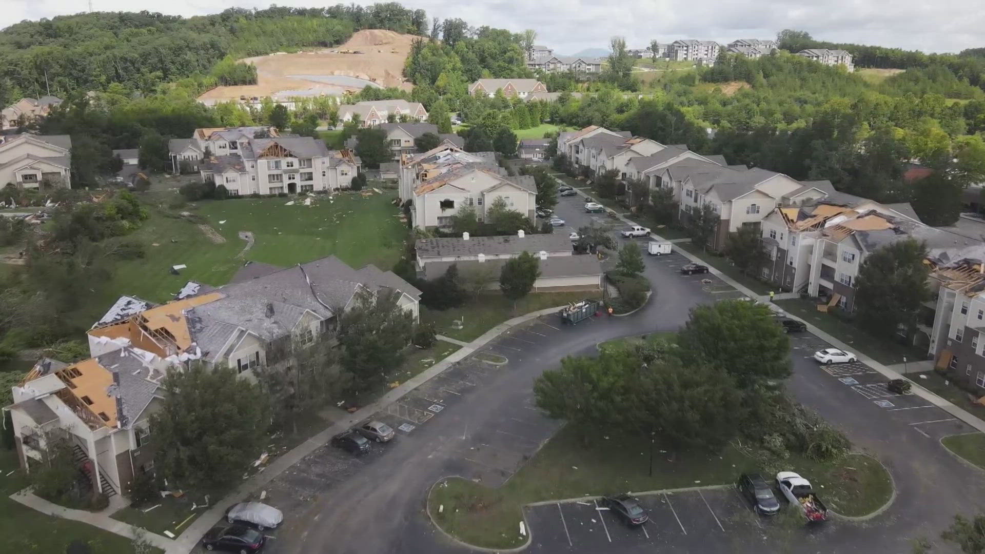
KNOXVILLE, Tenn. — An EF1 tornado touched down in Northeast Tennessee Tuesday evening, as a round of storms swept through the area bringing rain and gusty winds.
The National Weather Service said the EF1 tornado touched down in Hancock County. An EF1 ranking denotes a tornado with gusts of between 86 mph and 110 mph, capable of damaging homes and injuring people. The weather service said it was the first September tornado in East Tennessee in decades.
Kelsey Ellis, a Geography Professor at the University of Tennessee, said East Tennessee saw its first August tornado last year. She said it's interesting history has been made with tornadoes within the last few years, but she wouldn't say it's uncommon to see them this time of year.
"We are approaching the fall months when tornadoes aren't uncommon in the southeast, and in Tennessee. And so, if we attribute this to being a fall tornado, it's not particularly uncommon. And so, I think what we're seeing is it just happened a little earlier this year — that we got the conditions right for something like this to happen," said Ellis.
She said these early fall tornadoes shouldn't scare people into thinking they're becoming more common in East Tennessee, but they should be aware there is always a risk tornadoes could develop during storms.
East Tennessee is in for another round of rain as Hurricane Helene approaches the South. Ellis said the biggest threats from that storm are flooding and strong winds. She said, thankfully, the impact of the hurricane should mostly be contained to the east, on the North Carolina side of the Great Smoky Mountains.
"One interesting thing about Helene that is favorable for East Tennessee is that, because she will be to our east, all of the rain that's approaching us has to come down the mountains and that actually dries air out," she said. "We're really saved by what we call these downslope winds that are going to help dry out some of these outer bands."
She said maps of the predicted rainfall from the hurricane show that if the Knoxville area gets up to 6 inches of rain, western North Carolina would get up to 15 inches of rain.
Anyone on the roads during severe weather should remember to never drive through large puddles and flooded roads. There's no way to tell how deep they actually are, and trying to drive through them can damage vehicles and trap people in cars.