KNOXVILLE, Tenn. — It seemed like the spigot for rainfall completely shut off at the beginning of September with only 0.42" of rainfall recorded that month, only 12% of the 3.49" we would typically receive.
September 2023 is tied for the fifth driest September in the 152 years of climate data for Knoxville.
Having the eleventh driest October on record didn't help and drought conditions continued to expand and worsen into November.
Wildfires began to pop up as "exceptional" drought (worst level) spread across the Central and Southern Valley through the first half of the month... But then things changed.
1"-2" of rain on Nov. 21 was more than we had seen in September and October COMBINED and it opened the doors for more beneficial rain events.
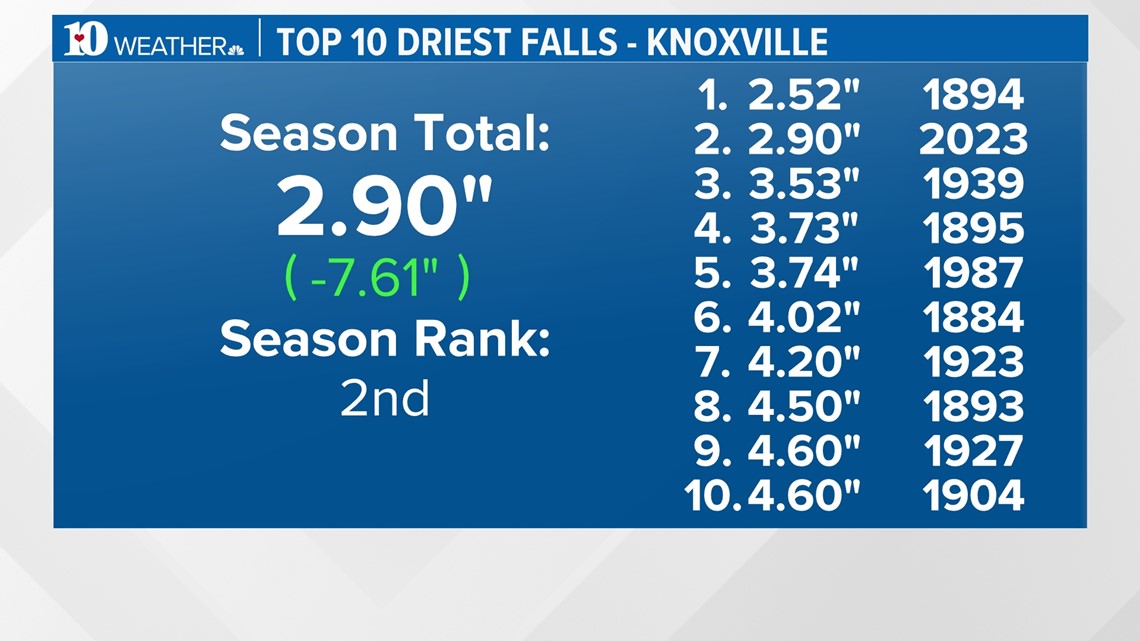
2023 will go down as the 2nd driest Fall on record with only 2.90" from September 1st through November 30th.

After receiving only 28% of our average rain during Fall, we will be moving into Meteorological Winter (December-February) with a hefty rainfall deficit.
So what can we expect over the next 3 months?
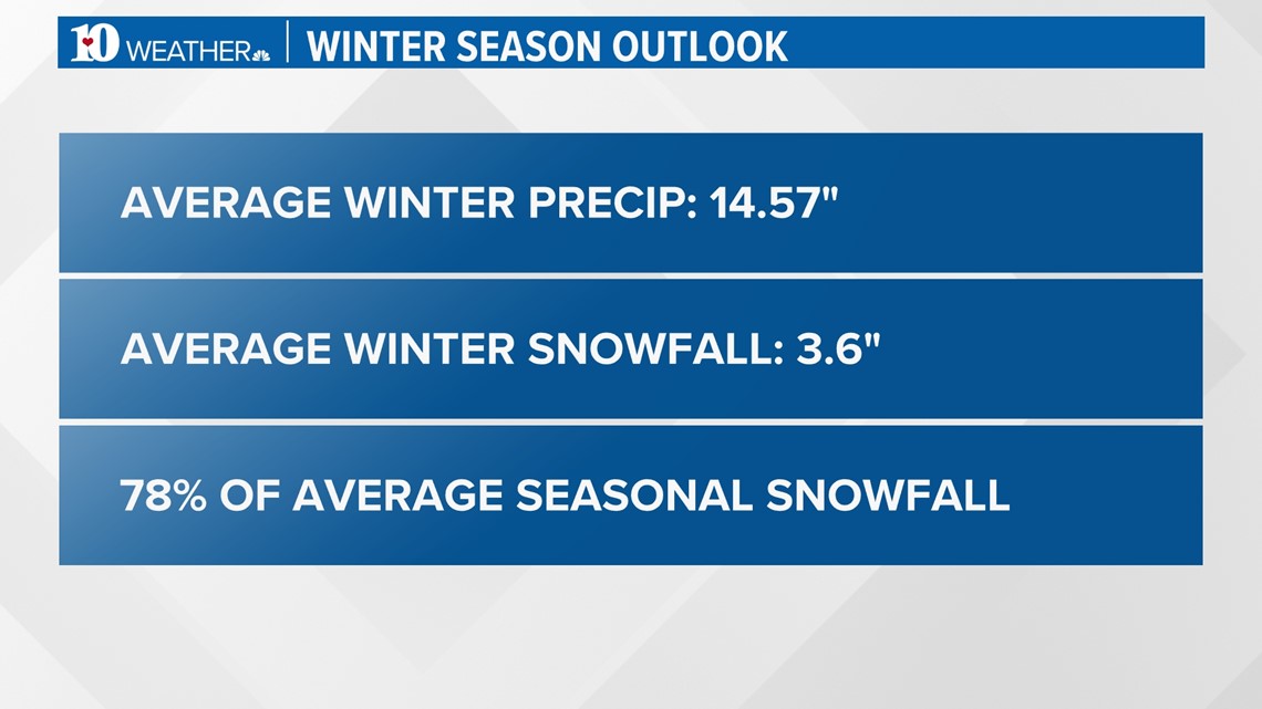
By the averages, December through February is actually our wettest 3-month period of the year with about 14.57" expected during this time.
We average 3.6" of snow during Winter, which is 78% of our average season total of 4.6".

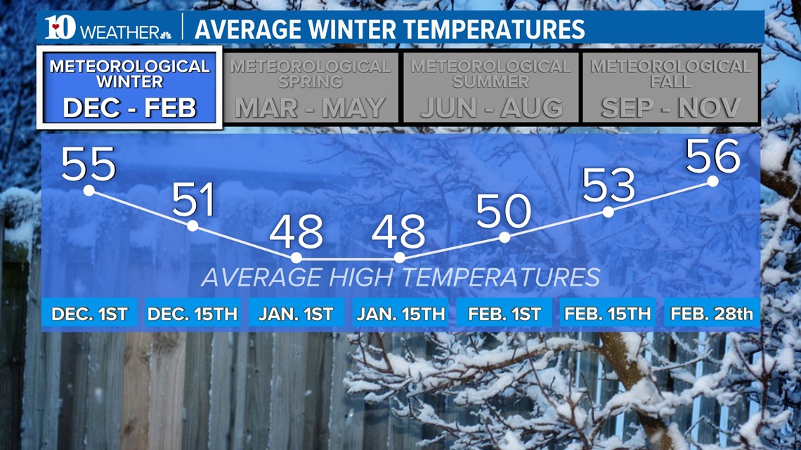
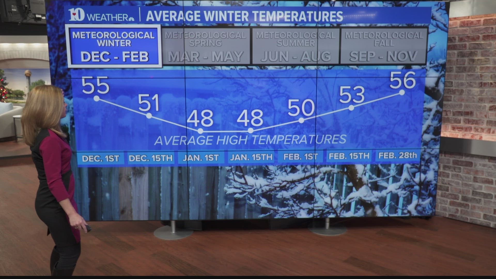
Meteorological Winter is also typically the coldest time of year.
Average highs drop into the middle to upper 40s through the month of January, then slowly warm through the 50s in February.