
KNOXVILLE, Tenn. — We are FINALLY starting to see some improvement in the drought conditions across Tennessee!
It seemed like the spigot for rainfall completely shut off at the beginning of September with only 0.42" of rainfall recorded that month, only 12% of the 3.49" we would typically receive.
September 2023 is tied for the fifth driest September in the 152 years of climate data for Knoxville.
Having the eleventh driest October on record didn't help and drought conditions continued to expand and worsen into November.
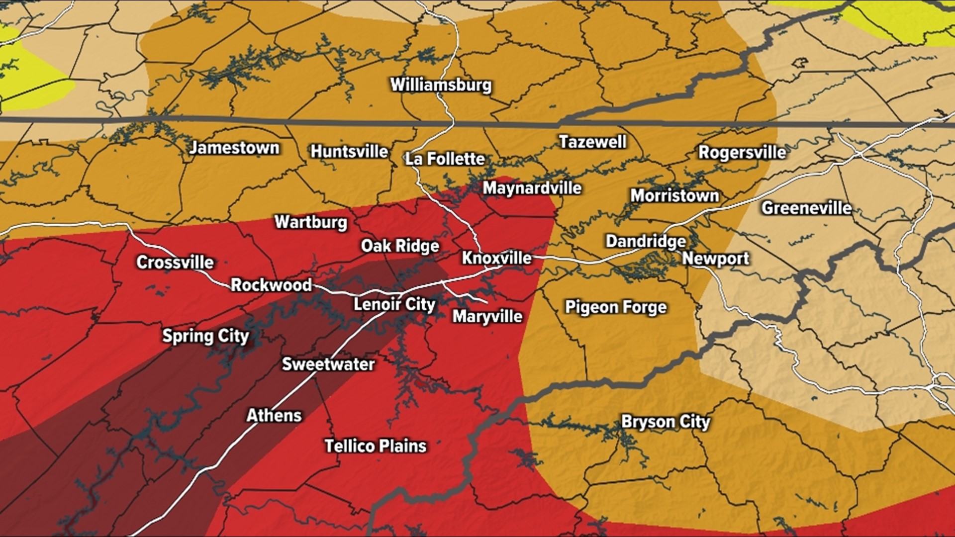
Wildfires began to pop up as "exceptional" drought (worst level) spread across the Central and Southern Valley through the first half of the month... But then things changed.
1"-2" of rain on Nov. 21 was more than we had seen in September and October COMBINED and it opened the doors for more beneficial rain events.

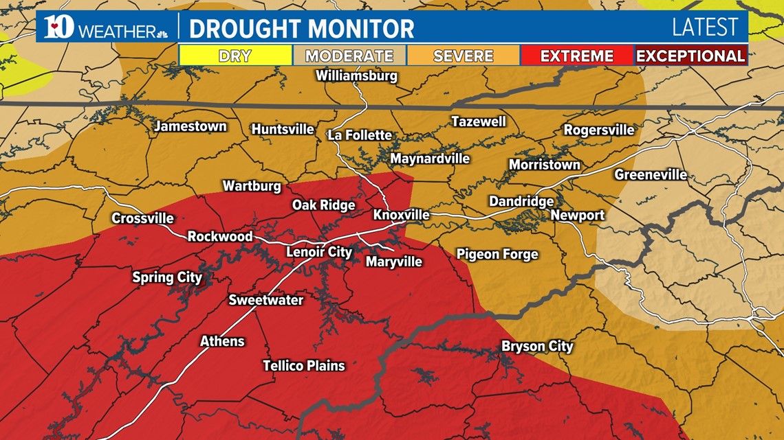
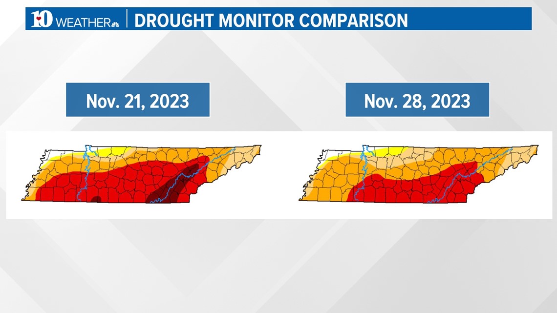
The latest drought monitor released on Nov. 30 shows HUGE improvements to the dry conditions across East Tennessee.
All of the "exceptional" drought (worst level) has been removed and all other levels have been reduced in coverage area.

It's important to note that we are not out of the woods just yet. It took two and a half months for this drought to develop so it's going to take a while for these dry conditions to go away.
This year will go down as the second driest fall since records began back in 1871 for Knoxville.
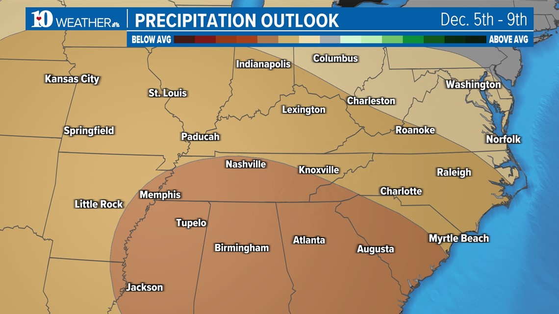
While we do have some rain in the forecast this weekend, long-range outlooks show chances for below-average precipitation during the beginning of December.

Please continue to practice fire safety and conserve water when possible, but we are happy to celebrate the small victories as we (hopefully) start to see a pattern chance moving into winter.