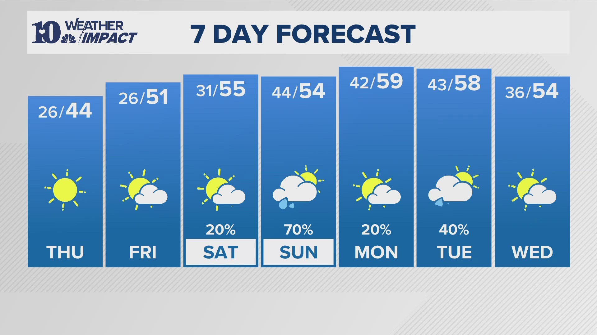
KNOXVILLE, Tennessee — East Tennessee will get a brief reminder that it is indeed still winter. A hard freeze is expected over the weekend.
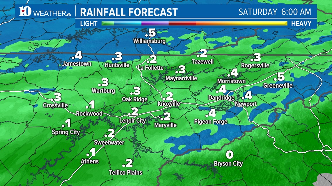
So far, nearly every day this month has recorded a high temp above normal. Before temps plunge for the weekend, a cold front will bring scattered showers by sunset Friday and briefly change over to a wintry mix before exiting to the east Saturday morning.
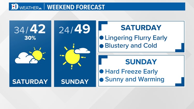
A few flurries will remain possible through mid-morning Saturday. Little if any accumulation is expected, but rain gauges across the area may register from a tenth of an inch to a half an inch from scattered showers.
Thereafter, clouds will slowly erode and allow the sun to peak through on Saturday and dominate on Sunday.

Winds will also increase with gusts expected to be as high as 20 to 30 mph, especially for the higher terrain.
East Tennesseans will be waking up to temps in the middle to low 30s but with the wind, it will feel more like the 20s.
From there, temps will be struggling to top out in the low 40s by Saturday afternoon, which will be over 10 degrees below our typical high for this time of the year.
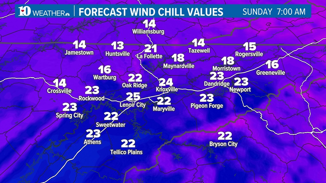
Morning lows will only become colder on Sunday and Monday as temps dip well into the 20s.
Make sure to take proper precautions with outdoor plants and pets until temps get back above freezing later next week. Furthermore, expect it to feel bitterly cold Sunday morning because wind chills may be in the teens at times at the beginning of the day.

By the middle of next week, coats will no longer be necessary in the afternoons but you may still want a jacket in the mornings. Stay warm and have a wonderful weekend!