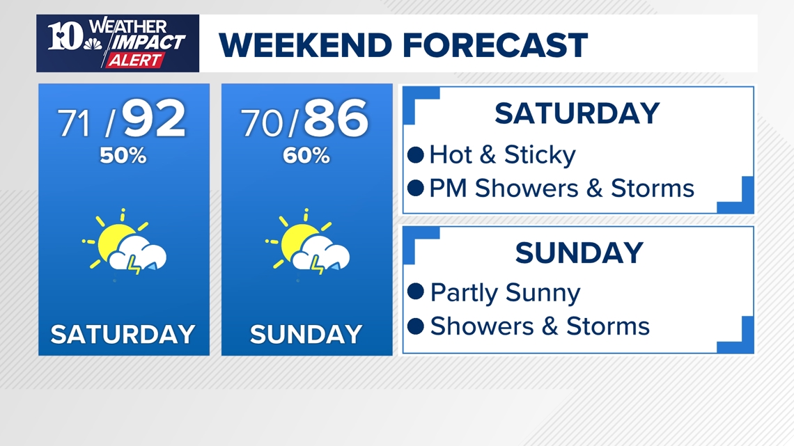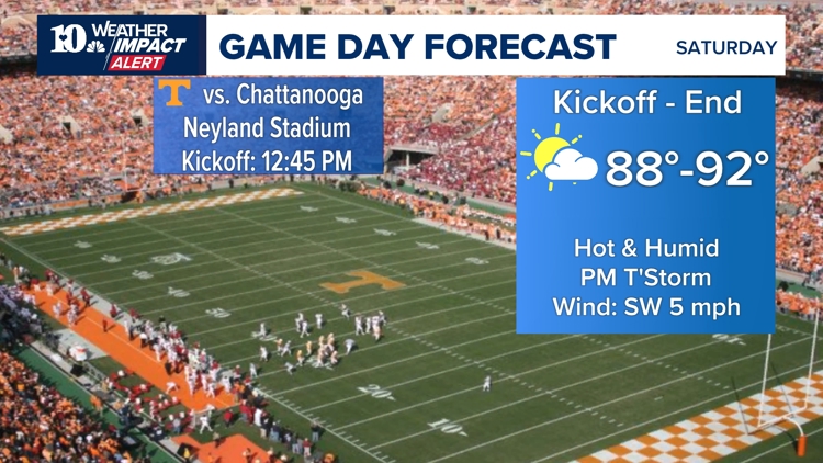
KNOXVILLE, Tenn. — The first 2024 UT game is Saturday, and those in attendance will have to bear the heat and humidity since the game is scheduled during the hottest part of the day.
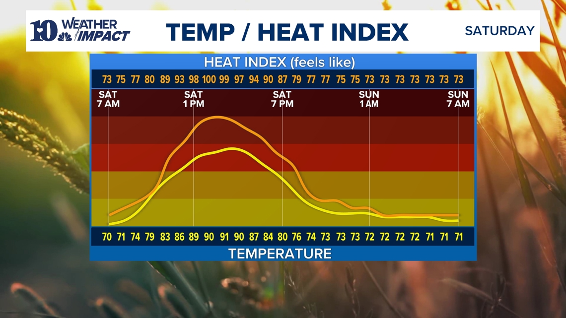
Kickoff is at 12:45 pm and by that time, temps will be pushing 90 degrees with a potential heat index around 95 degrees.
If you're attending the game, be sure to wear lightweight clothing and drink plenty of water, especially if you are sitting in full sun. It is probably a good idea to frequently apply SPF 30 or greater sunscreen to avoid getting a bad sunburn.

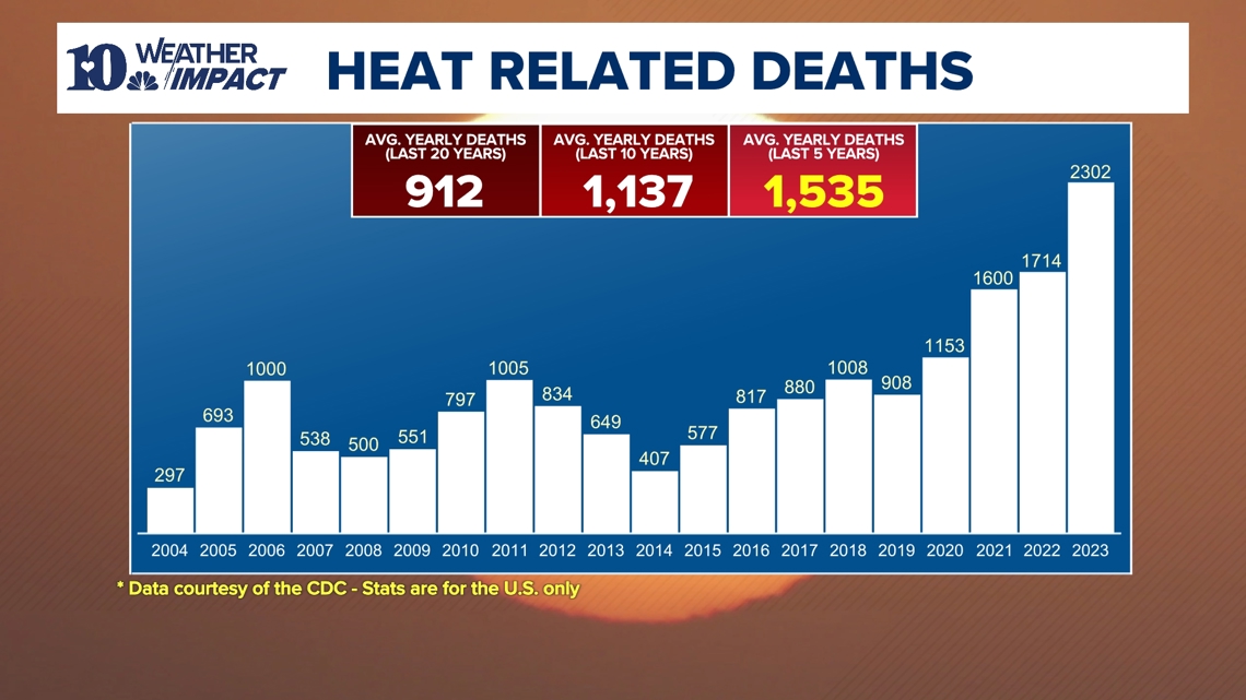
Each year, hundreds of people die of heat-related illnesses in the United States. Risk of heat-related injury or death can be reduced by taking proper precautions and by knowing the signs of heat exhaustion and heat stroke.
Be sure to stay hydrated when outdoors, find shade or go inside periodically to prevent heating up more than your body can handle, and keep an eye on others to be sure they are not showing signs of heat stress.

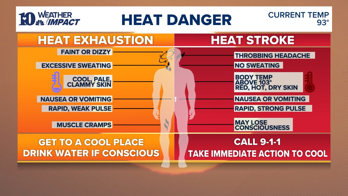
You may be experiencing heat exhaustion if you become weak or dizzy, start sweating more than usual, feel nauseated or start to vomit, have a rapid weak pulse, experience muscle cramps, or your skin looks pale and feels cool and clammy. If any of these symptoms are noticed, it's a good idea to drink more water and find a cool place to give your body time to recover from the heat.
If experiencing a headache, a body temperature above 103 degrees, a rapid pulse, or lack of sweat -- call 911 because heat stroke may be imminent.

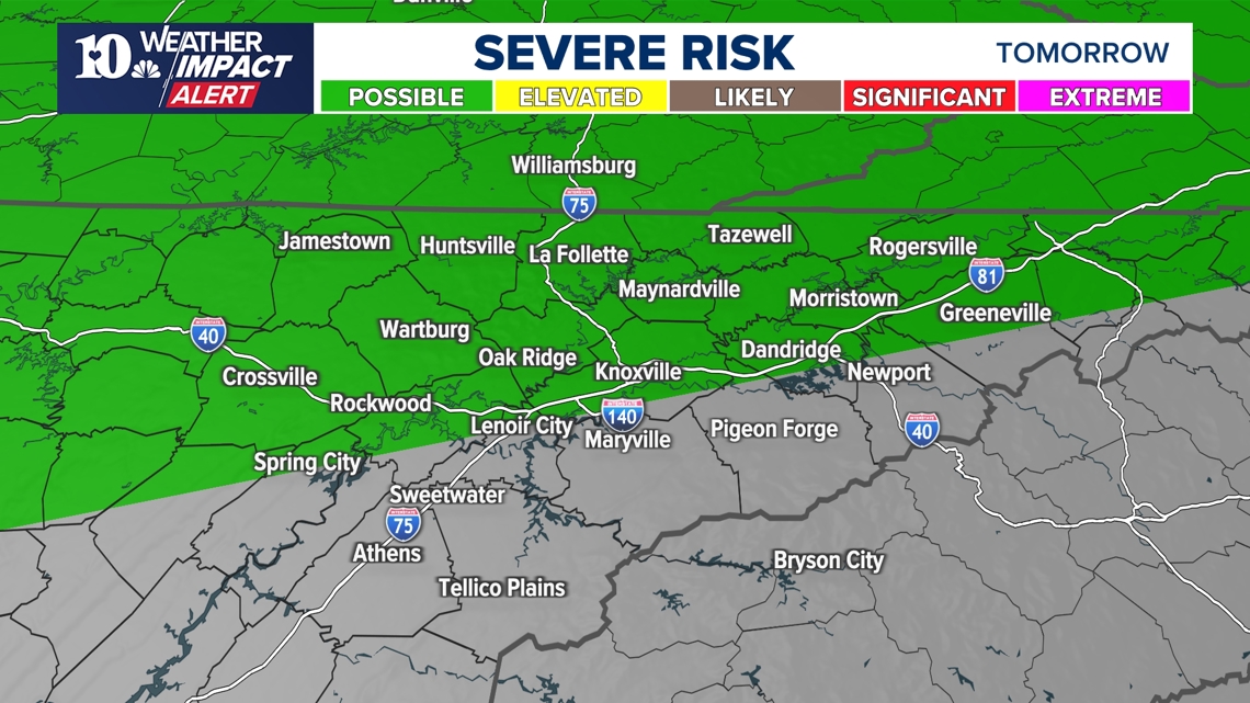
The high heat and humidity is not the only issue to pay attention to Saturday. Showers and storms are expected to build in the afternoon. There is a level one risk north of I-40 for the potential that some storms may briefly become severe with wind gusts over 50 mph and small hail.

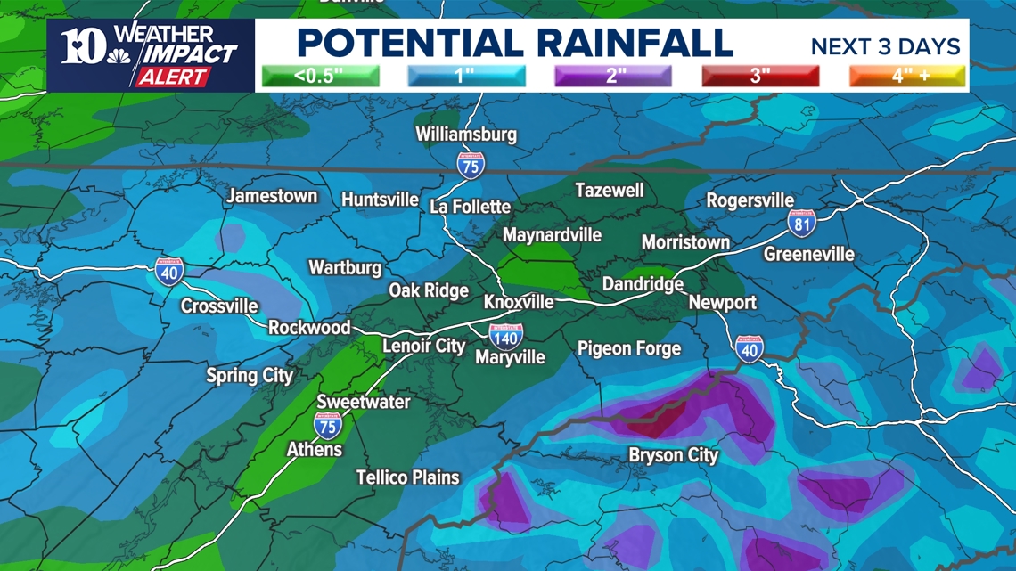
The rain is certainly welcome since it has been very dry over the past couple of weeks. There is a potential to get 1/2" to 1" of rain on average over the next three days.

Some good news. Temps will be lower on Sunday and continue to drop throughout next week too. Stay cool and have a safe and wonderful Labor Day weekend!