KNOXVILLE, Tenn. — Storms were forecast to move through East Tennessee on Friday, continuing the course of a weather system that has proved temperate and difficult to forecast.
The National Weather Service issued a Severe Thunderstorm Warning lasting until 7 p.m. for Scott County, Campbell County and Anderson County.
Another Flash Flood Warning was issued for Claiborne County, Hancock County and Hawkins County until 8:30 p.m. Eastern Time. Another Flash Flood Warning was issued for Morgan County, Scott County, Knox County, Campbell County, Anderson County and Union County until 10:30 p.m. Eastern Time.
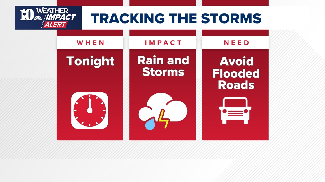
The storms can bring thunder, heavy rain and gusty winds. However, the major concern facing East Tennessee comes from the rain they leave behind. A Flood Watch was issued for most of East Tennessee until around midnight.
After days of passing showers, the area's soil is deeply saturated so water cannot be absorbed as quickly as usual. Instead, it is likely to puddle higher and higher. Streams and rivers can also overflow as a result of storms, threatening people who live near running water.
When will the weather impact me?


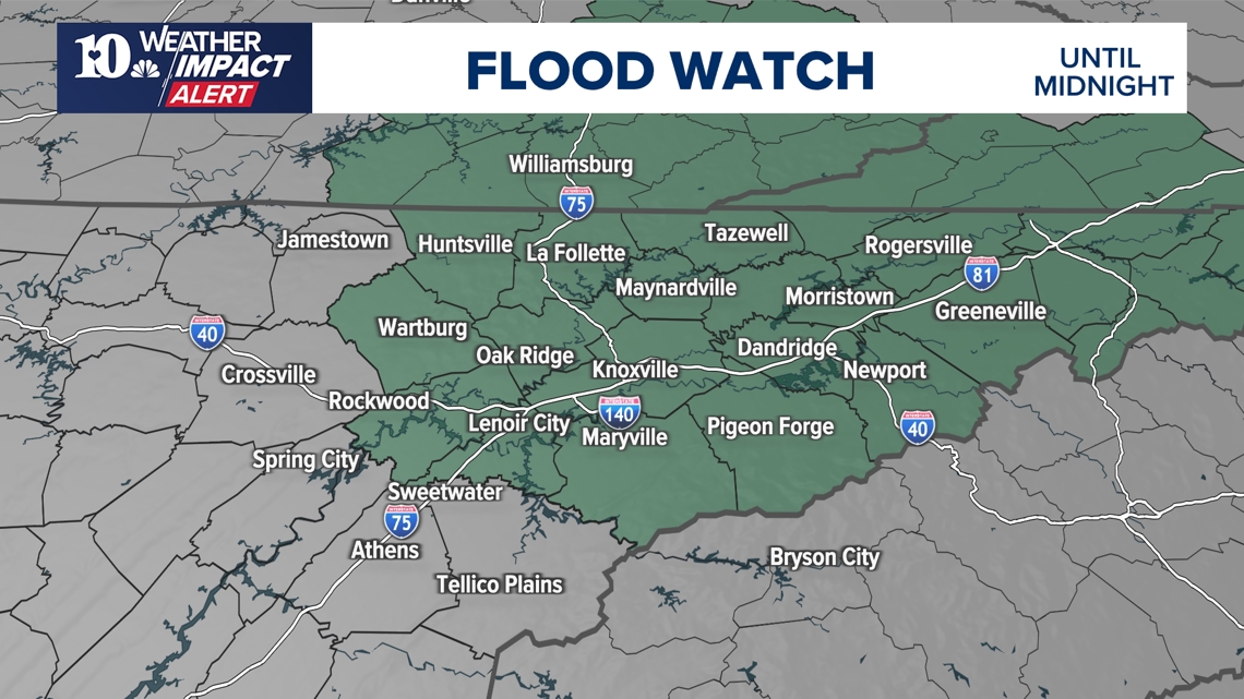
Much of East Tennessee is under a Flood Watch until midnight on Friday as conditions linger for flooding to develop. Rivers and streams can spill over and into the roads, resulting in hazardous driving conditions. Water can also pool in basins, rising higher than some people expect.
Most of the area under a Flood Watch is north of the I-40 interstate.
After around a week of on-again, off-again storms, there is a chance that Saturday would stay relatively typical with a diminished chance for severe weather. However, the weather system has proved difficult to track and people should still be wary of the chance for rain headed into the weekend.
What's the impact?
Storms can cause decreased visibility on the roads, and while Flash Flood Watches are in effect there is a higher chance of floods covering some parts of major roads. Nobody should drive through flooding — often large puddles may be deeper than they appear, trapping people in their vehicles if they try to go through them.
Drivers should make sure to slow down, leave extra space between vehicles and ensure their headlights are turned on when on the road. The best safety measure is to generally avoid the roads during severe weather.
Gusty winds and small hail are also possible. With the ground saturated from previous storms, it could also be easier for trees to fall — causing damage and potentially taking out power for some communities.
It's also important people remember that if they hear thunder, they should go inside. Thunder signals an approaching strong storm that could cause damage.