
TAMPA, Fla. — Editor's note: Hurricane Milton formed in the Gulf of Mexico on Sunday, Oct. 6. Please click or tap here for the latest updates.
Tropical Storm Milton strengthens as it moves toward Florida, according to hurricane forecasters.
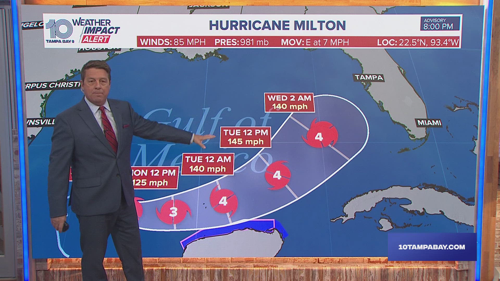
Milton formed in the Gulf on Saturday and is expected to quickly intensify and be at Category 2 or 3 hurricane strength when it reaches the west coast of Florida.
The National Hurricane Center announced that their NOAA Hurricane Hunter aircraft "finds a stronger Milton."
Florida could see impacts beginning Wednesday.
The storm is about 860 miles west-southwest of Tampa with maximum sustained winds at 65 mph.

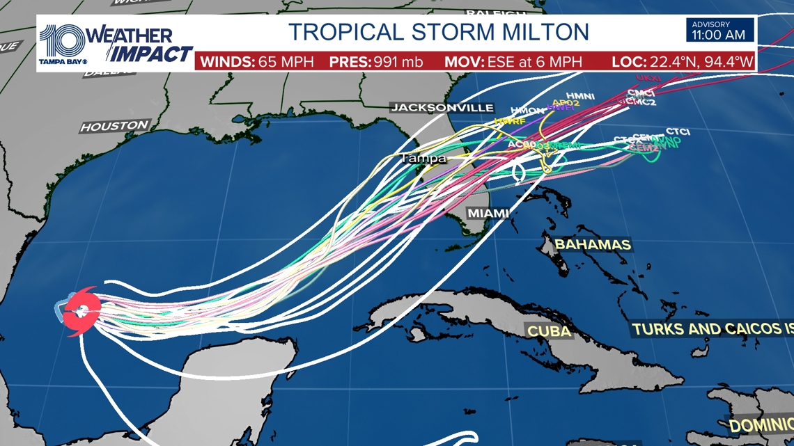
As of the latest advisory, a Tropical Storm Watch is currently in effect from Celestun to Cancun Mexico. Hurricane and storm surge watches will likely be required for portions of Florida late Sunday.
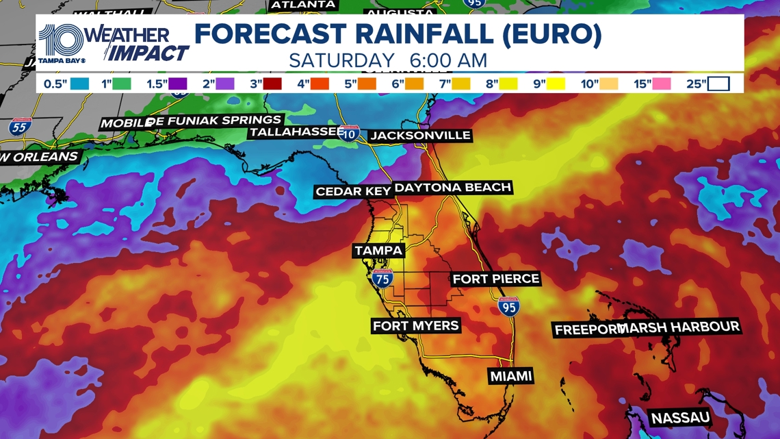
Rainfall from Milton is expected to range between 5-8 inches with localized totals up to 12 inches across portions of the Florida Peninsula and the Keys through Wednesday night. That rainfall will bring risks of flash, urban and areal flooding along with minor to moderate river flooding, according to NHC. A Flash Flood Watch is in effect for the Florida Peninsula starting Sunday morning.
A wave of moisture ahead of a developing system will bring tropical downpours to the region beginning on Sunday. Although this won't be a washout of a day, times of heavy rain dumped over localized areas could lead to flash flooding.
With a front sinking in from the north, the areas prone to seeing most of the rain will exist along and south of I-4. Coastal areas should pay close attention to the forecast and have a way to receive alerts in case a flash flood warning were to be issued. Anticipated rainfall from Sunday night to Wednesday will range from 3" - 6" with higher totals possible in isolated spots.

By Wednesday as what is expected to be Hurricane Milton our impacts will also include storm surge and damaging winds. Keep checking back for updates.
Now, let's take a look at what's going on in the Atlantic.
Hurricane Kirk formed Tuesday, becoming the seventh hurricane of the 2024 Atlantic hurricane season. Kirk remains a major category 3 storm at this time, recently weakening from Cat 4 status. No impacts to Florida with this storm.
Hurricane Leslie is also expected to stay out in the open Atlantic.
Another tropical wave off the coast of Africa formed earlier Friday afternoon, but chances of development remain low.
Our 10 Tampa Bay Weather team will continue to monitor any development and keep you informed, prepared and connected through the rest of hurricane season.