Are you tired of the rain? Well, unfortunately there is more in the forecast...
A series of systems will move across the region this week and each will add to our already impressive rain totals.
The ground is saturated, meaning that it can't hold anymore water.
Basically, whatever rain falls from the sky will almost exclusively become runoff instead of soaking into the ground.
In addition to the saturated soil, rivers, creeks and streams are running high from the rain events that we've already had this month... And that raises the potential for flooding.
The Tennessee Valley Authority (TVA) has been releasing large amounts of water from area dams in an effort to make room for the potential rainfall this week.
RELATED: TVA prepping for rainy week ahead
So, what can we expect?
Scattered showers will move back in during the early evening.
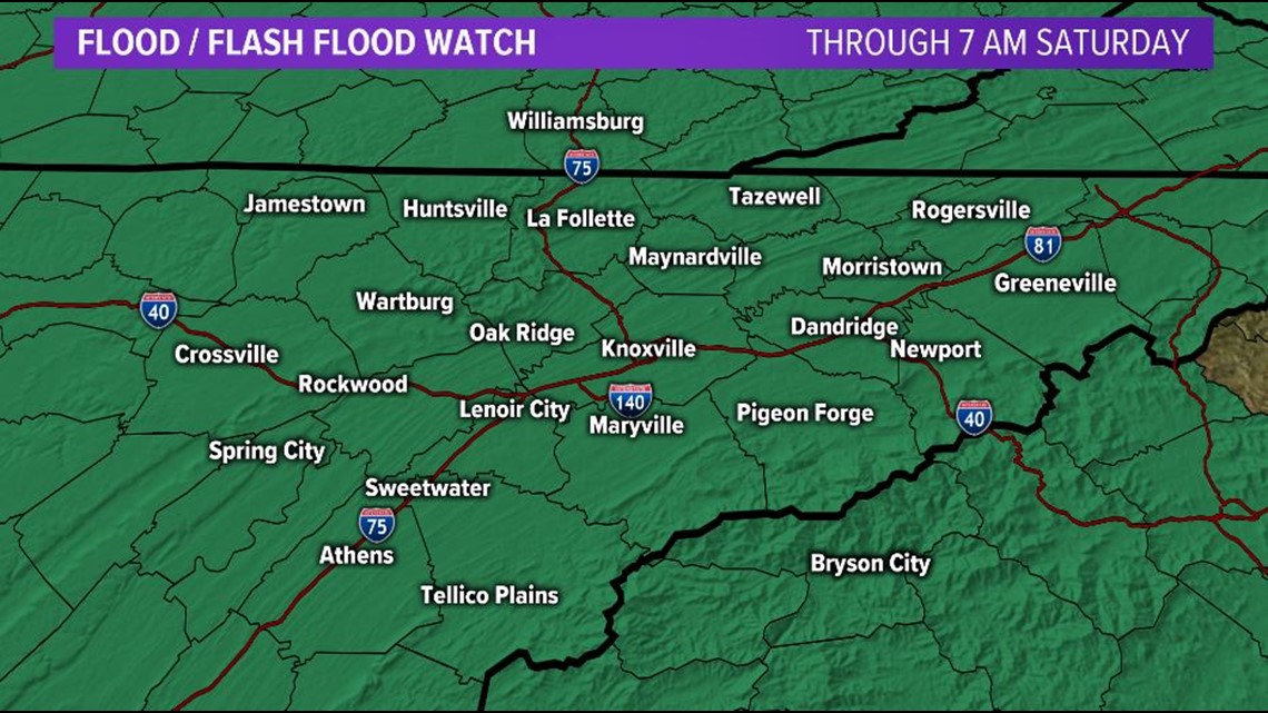
**A Flood and Flash Flood Watch will be in effect now through Saturday morning.**


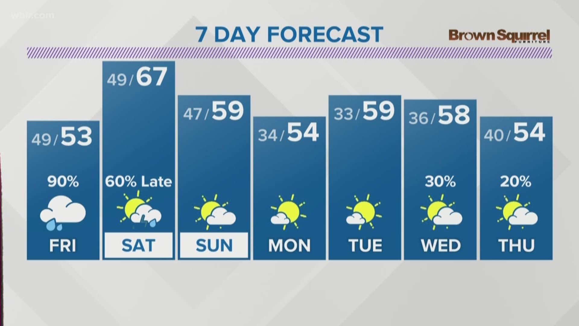
The potential for heavy rain and more flooding returns on Friday as another boundary sets up across the region.
Off and on periods of heavy rain will be possible into the weekend and the potential for flooding and possible impacts will increase each day as the totals continue to add up.
Flooded basements, mudslides and standing or running water on roads will all be possible for the next several days.
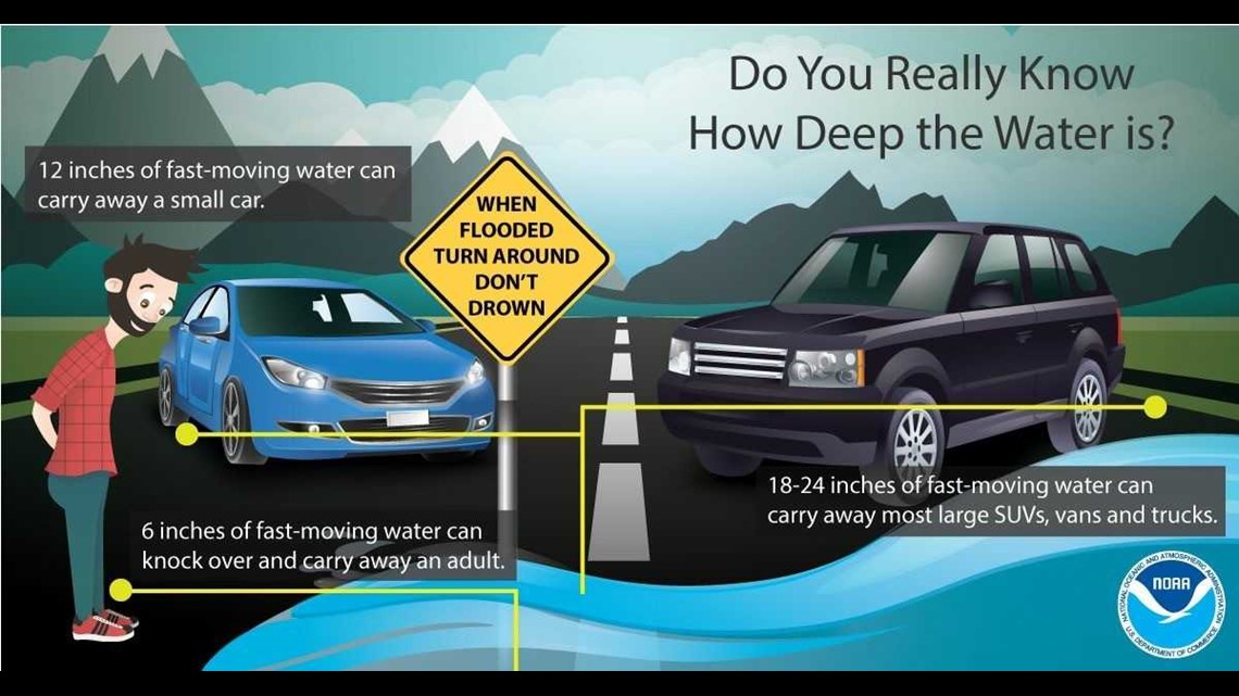
**NEVER DRIVE THROUGH FLOODWATERS!!!**


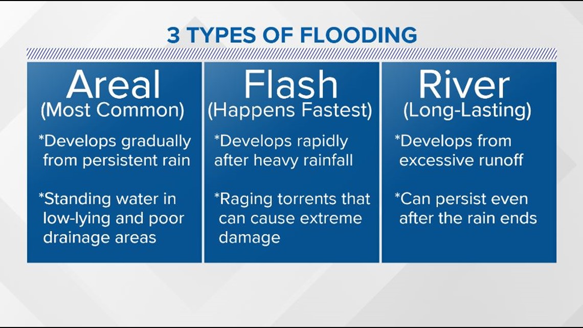
Areal flooding is already occurring after all the rain that we've had recently.
Flash flooding will be possible when heavy rain is moving through.
River flooding will likely develop by the end of the week as water levels will continue to rise.
*If you live near a body of water that typically floods when we have heavy rain, keep an eye on water levels and be prepared to move to higher ground if necessary.*


For a detailed break down of your forecast day by day, click here.
Check back for updates throughout the week and stay safe!

