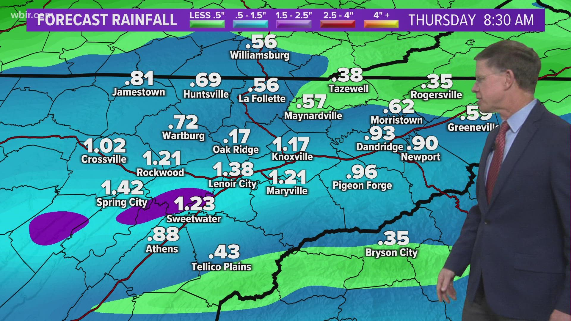
KNOXVILLE, Tenn. — The first of two systems move in this evening with showers & strong storms possible. A second strong system moves in New Years Day Saturday and Saturday night with more heavy rain and possible strong storms. The combination of these two systems could bring our region significant rainfall and possible flooding once the ground becomes saturated. Be advised of this potential and plan on using caution while driving on area roads.
The heavier round of showers and storms today is expected to arrive by this evening between 6-10 p.m. There will be the chance for some severe storms during this time frame along with the potential for some flooding where heavier showers occur.
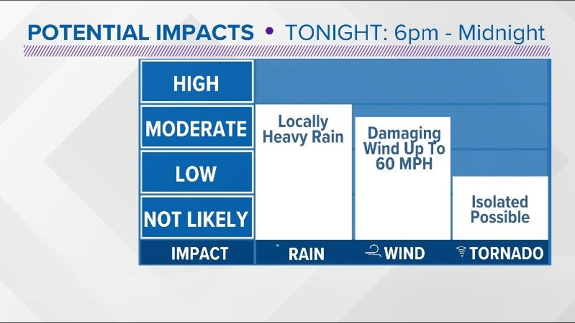
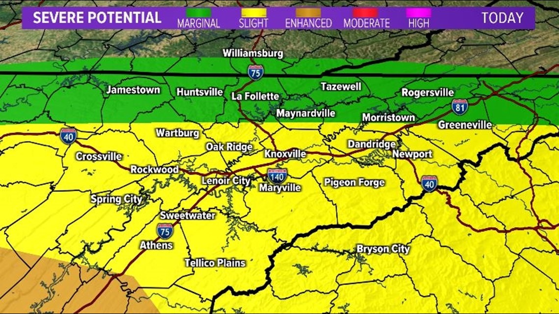
**There will be a chance for strong to possibly severe storms this evening. The main timing will be between 6 p.m-Midnight. The greatest chance for potential severe weather will be South of I-40 across the Southern Valley. The main potential impact is possible damaging winds**


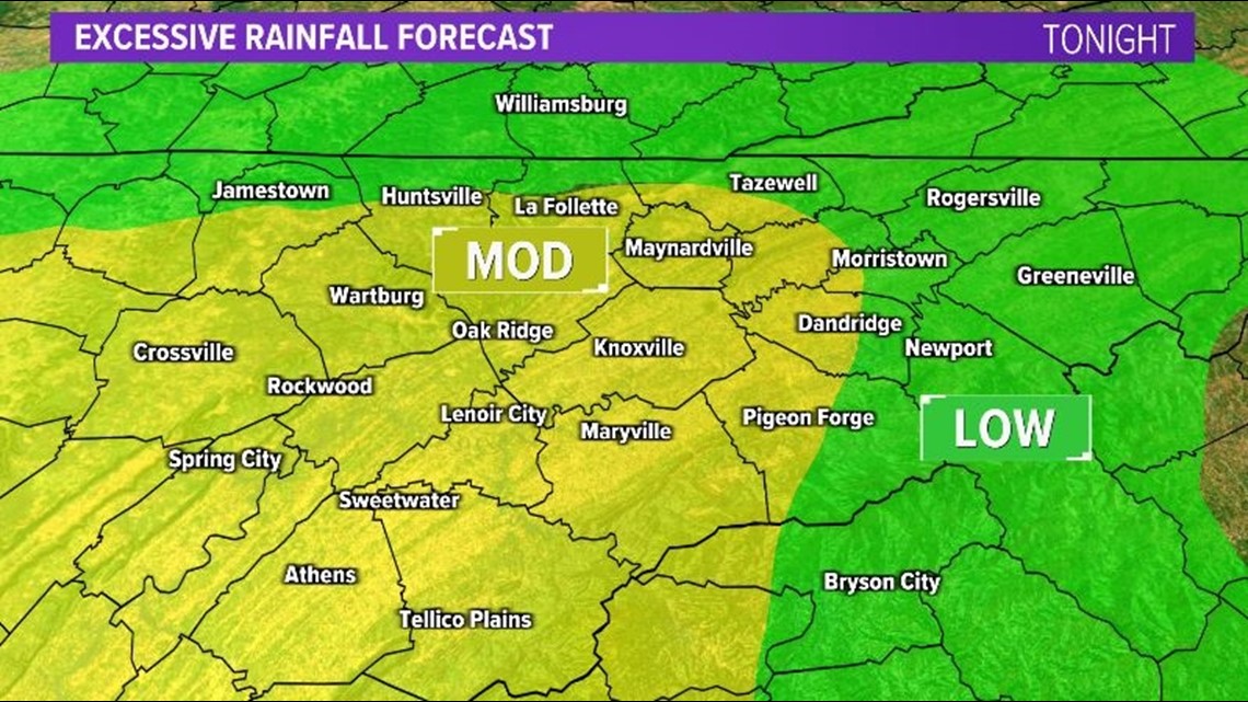
**There will also be the chance for excessive heavy rainfall Wednesday night. Rainfall totals could range between 1"-2.5". This could lead to pockets of flooding in our region, especially for areas shaded in the "Moderate" category below.**

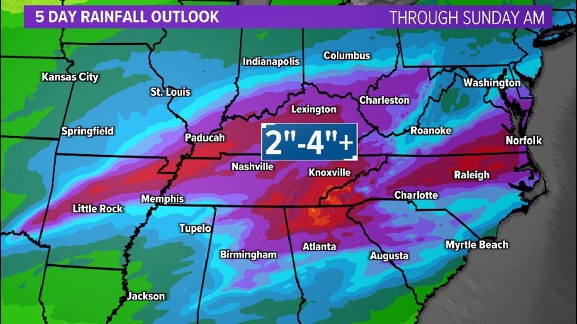
**Total rainfall through Sunday AM could range between 2"-4" or more in some areas when you combine the rain from Wednesday and Saturday's storm systems. Heavy rain on top of saturated soils could lead to flooding in our area this New Years Weekend. Be advised and use caution on area roads. Always avoid flooded roadways!**

Stay tuned to 10News and wbir.com for up-to-date weather information as this active weather pattern unfolds today and into the New Years Holiday Weekend.
The National Weather Service also said people should find ways to stay connected during severe weather. They said people should have multiple ways to get information and stay "weather aware."
They can use weather apps on phones or tablets to track storms, tune into local news and radio shows, and the National Weather Service also offers updates 24 hours a day.
People in the lower parts of East Tennessee should make sure to stay connected Wednesday evening, as the storm moves slightly more south than expected.

