Roads may become slick overnight due to refreezing of any liquid on the ground.
Use extra caution on untreated or unpaved secondary roads on your Wednesday morning commute!
► ALSO RELATED: Tips for winter weather driving
Some schools will be delayed or closed again on Wednesday due to the potential for hazardous road conditions. You check the latest list here.
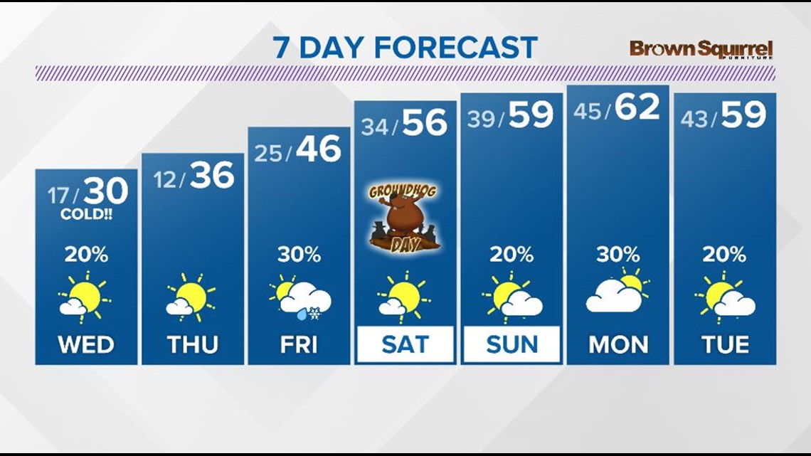
The arctic air has arrived and a secondary (mostly dry) front will move through on Wednesday morning, keeping temperatures in the 20s through the day.
A few flurries will be possible in areas along and north of I-40 but little to no accumulation in expected.
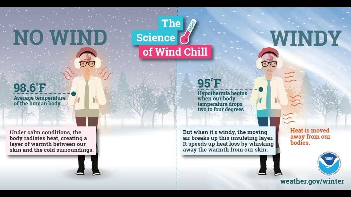
Breezy winds out of the west at 10-20 mph will keep wind chills in the single digits and teens all day despite the sunshine.
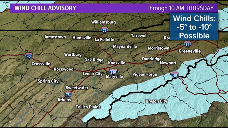
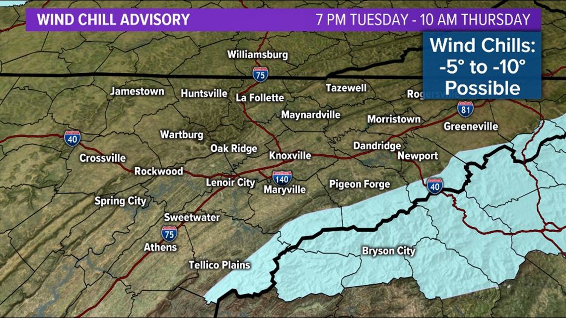
**A Wind Chill Advisory will be in effect for the higher elevations of the Smokies from Tuesday night through Thursday morning. Wind chills could be as low as -5° to -15°.**

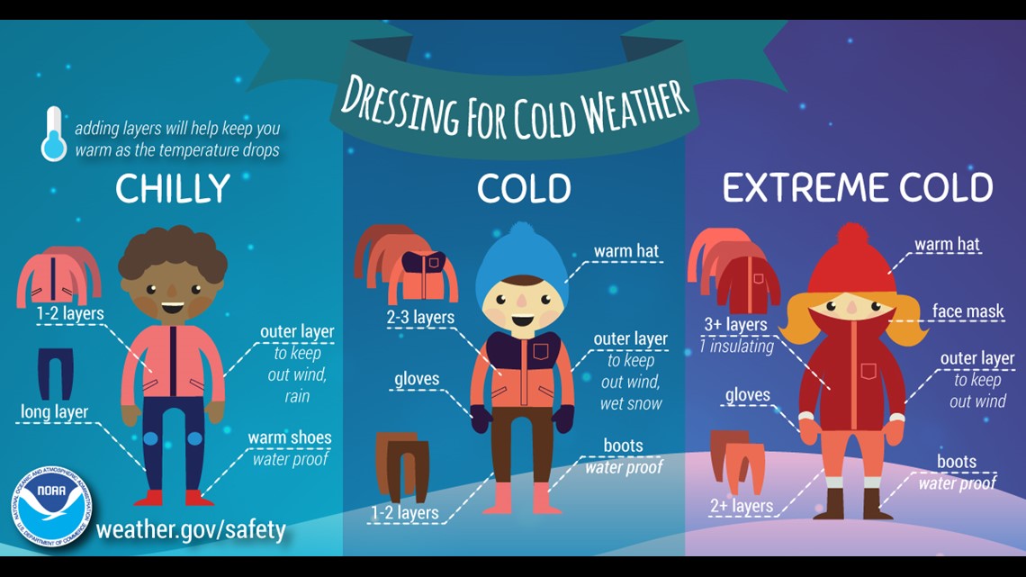
Be prepared to dress properly if you'll be outdoors!
►Winter Prep: Use household items to help thaw out cold weather
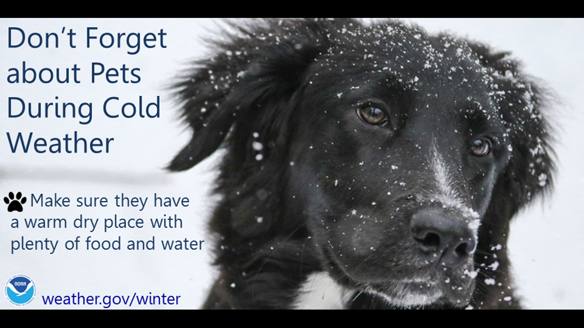
Bring in pets or give them a warm and dry shelter with plenty of food and water!
Wind chills could drop into the single digits or teens below zero again on Wednesday night.

The good news is that warming trend will begin on Thursday and we will see highs back into the 50s by the weekend!
►Make it easy to keep up-to-date: Download the WBIR 10News app now and sign up for our Take 10 Lunchtime Newsletter.
Have a news tip? Email 10Listens@wbir.com, or visit our Facebook page or Twitter feed.