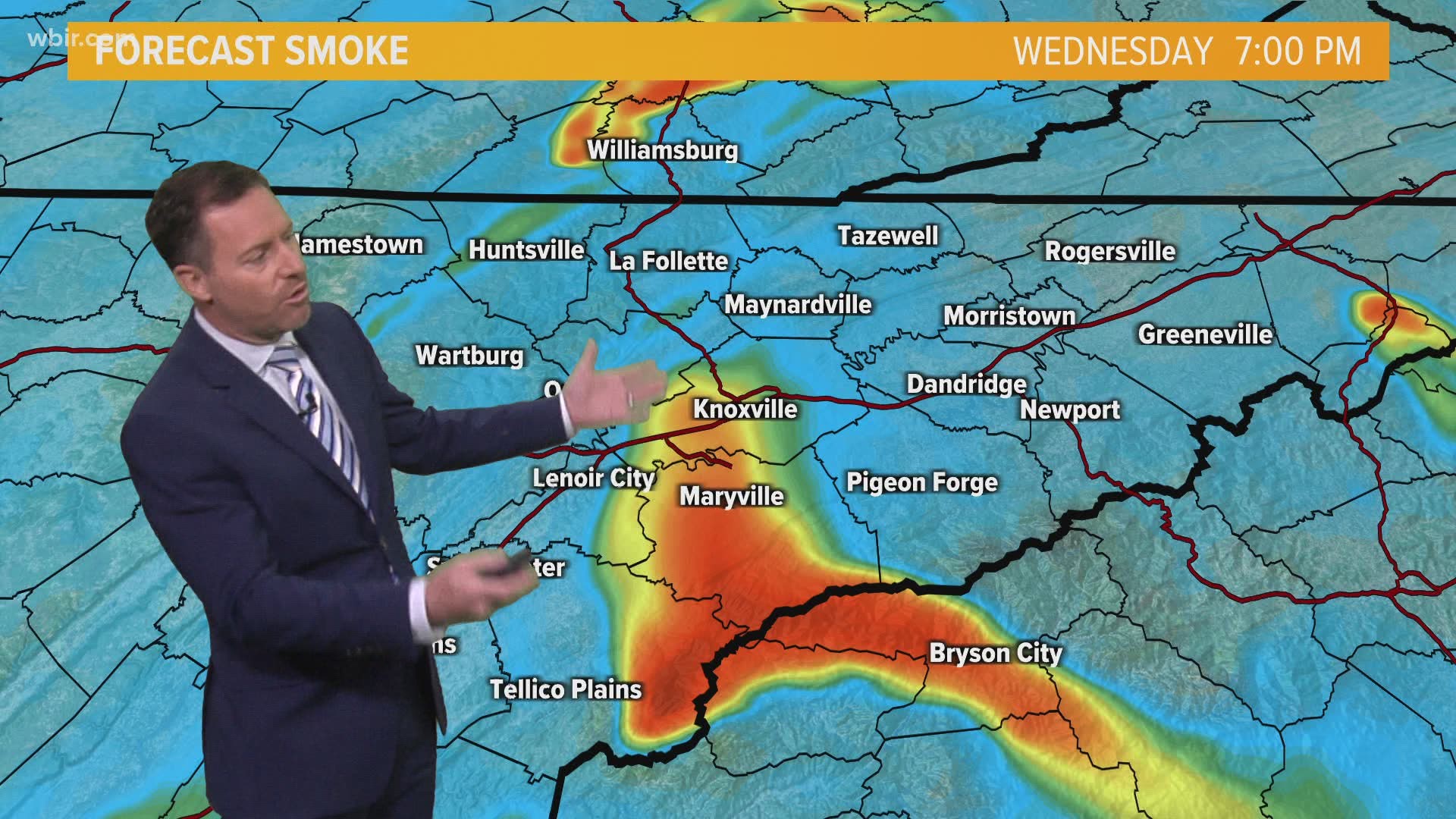
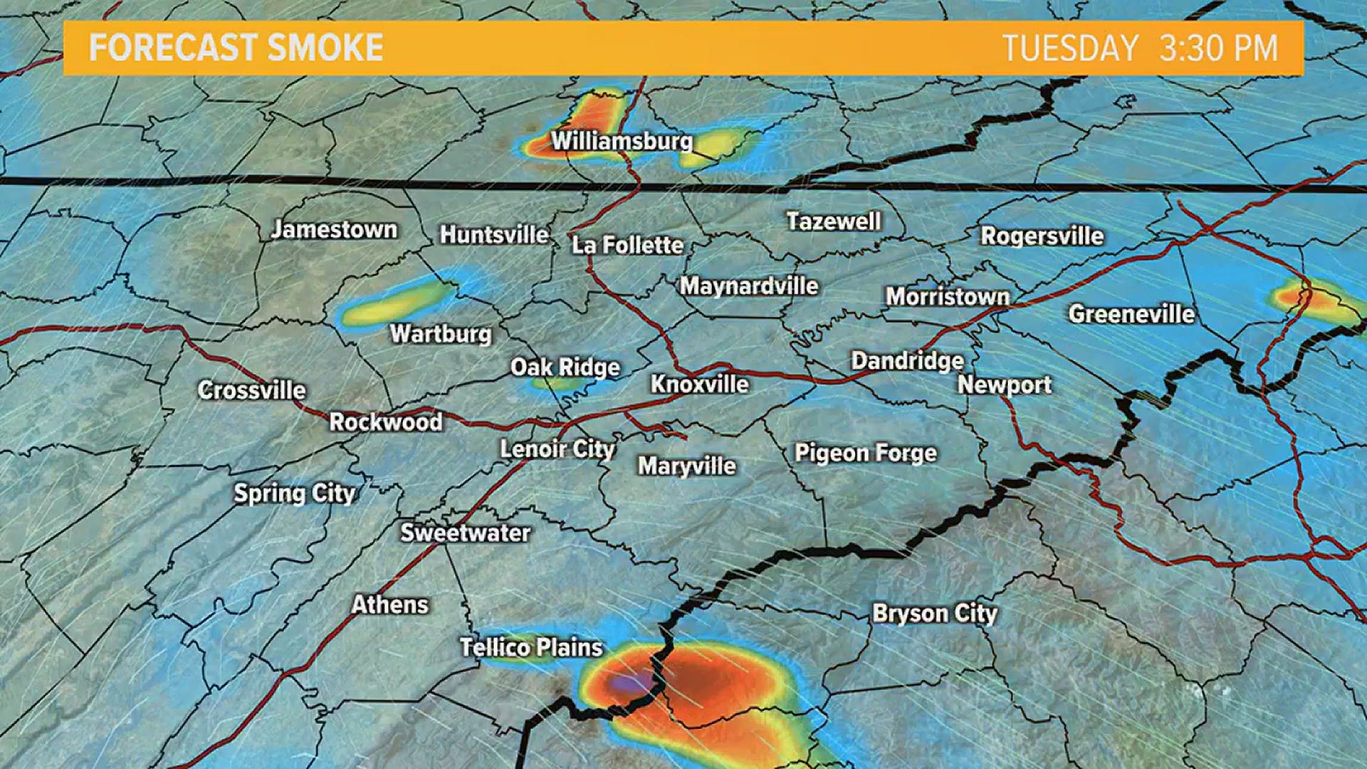
People across East Tennessee are reporting the smell of smoke and haziness in the air. What's causing it?
There are a number of prescribed burns going on right now, and the smoke from those fires is just spreading across the area and settling low to the ground.
All that smoke contributed to poor air quality earlier this morning. According to Airnow.gov, Knoxville had an Air Quality Index (AQI) of 145 at 9 a.m. That's well into the "unhealthy for sensitive groups" range.
WBIR meteorologist Cassie Nall said the current weather conditions contributed to the air quality.
"On nights with calm winds, an inversion sets up and basically traps cooler/denser air below a layer of warm air. This happens all the time in the Valley," she said. "When there is smoke in that cool/dense layer, it basically keeps it very concentrated until the sun can warm the ground, which warms that air. Then when the wind starts to move the air around, it mixes the smoke out."
Rural/Metro fire spokesperson Jeff Bagwell told 10News that there were controlled burns happening Tuesday at Watt Road and Forks of the River in Knox County.
This week, the U.S. Department of Energy and the Tennessee Division of Forestry are doing controlled burns on the Oak Ridge Reservation. Fires are scheduled near Wisconsin Avenue, the North Boundary Greenway, and the west side of Wisconsin Avenue to the new Boulder Trail.
Nathan Waters with the Tennessee Division of Forestry said he knew there were prescribed burns going on Tuesday in Blount, Claiborne, Union, Morgan, and Scott counties.
More prescribed burns are planned this weekend in the Big South Fork National River and Recreation Area and in Monroe and Polk counties, so the hazy conditions and smelly air could continue into the weekend.
Agencies regularly conduct prescribed burns in wooded areas to provide wildlife habitat, encourage the growth of native plants, and reduce the risk of wildfires.
Big South Fork NRRA- April 6 & 7
Kentucky
- #1. Monroe field: 24 acres
- #2. Ledbetter A field: 11.8 acres
- #3. Ledbetter B field: 19.6 acres
TOTAL: 55.4 acres
Tennessee
- #1. Burke Fields: 20.7 acres
- #2. Dewy Blevins/Gar Blevins field: 5.8 acres
TOTAL: 26.5 acres
Monroe County- this weekend & early next week
- Wildcat- between Wildcat Creek Road and the Tellico River Road
- Waucheesi- along the Waucheesi Mt. Road (FSR 126C). FSR126 C road will be temporarily closed on Sunday for the safety of forest visitors.
- Miller Ridge- between Lost Cove Branch Road, Tavern Branch Road and Rafter Road.
- Maple Knob- between Tellico River Road and Bald River Road
- Green Cove- between Tellico River Road and Bald River Road
- Buck Branch- between Cherohala Skyway and the Tellico River Road.
Polk County
- Rough Creek- between FSR 221 and the Ocoee River.
- Laurel Branch- between FSR 221L, Tumbling Creek and the Ocoee River.


