
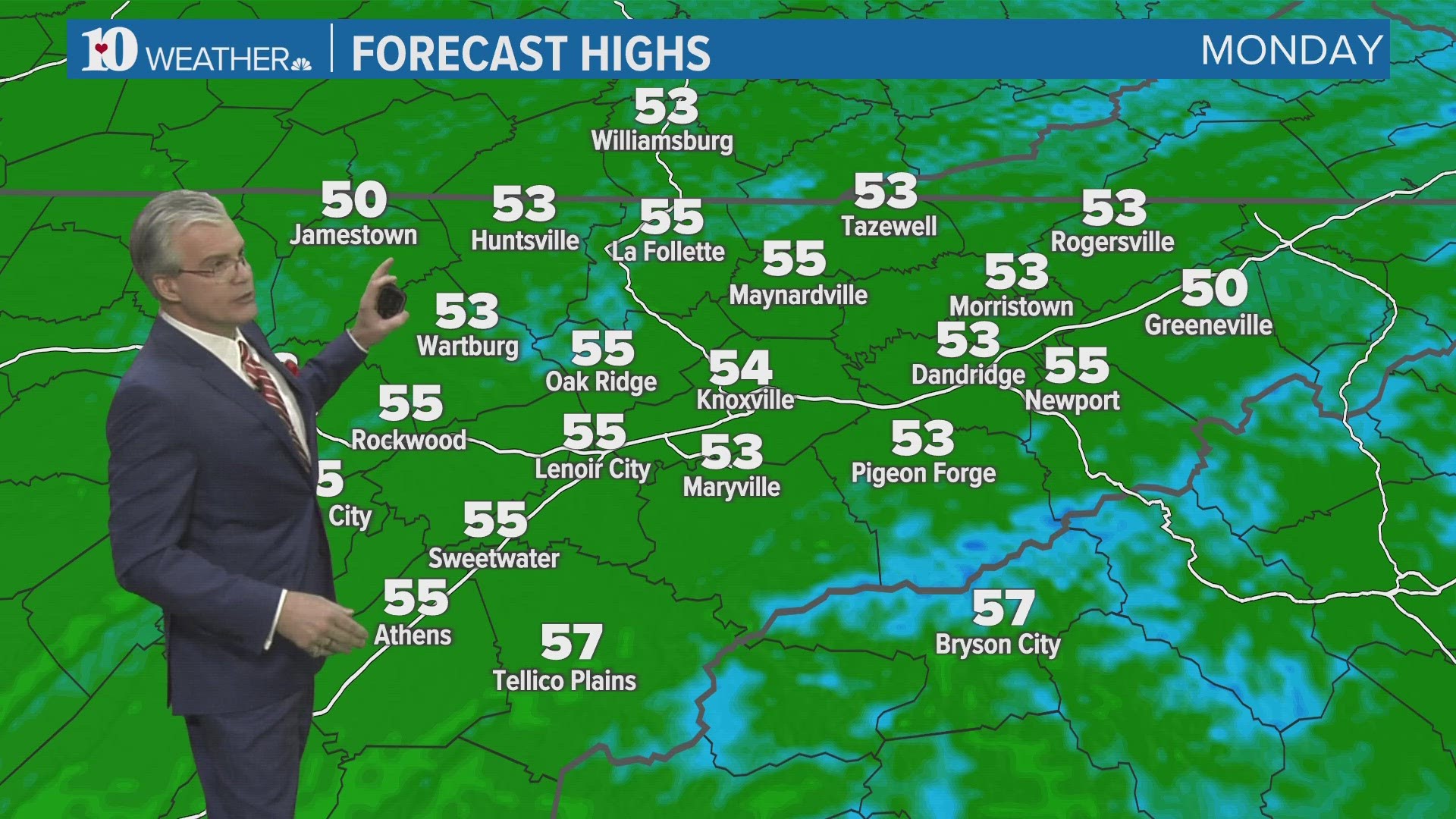
KNOXVILLE, Tenn. — The upcoming week will be mainly dry once we put Monday in the review mirror. A powerful low pressure to the south and west of Tennessee will be pushing a cold front through late Monday, which will usher in somewhat cooler temps and much drier air for the rest of the week.
Before that happens, showers are expected to spread into east Tennessee Monday along with a few thunderstorms by late afternoon Monday. There is a slight risk for severe storms due to 60mph winds, primarily south of I-40. Most stand a chance to get an additional 1/2" to 1" of rain, however, some places may have more than that due to thunderstorms.

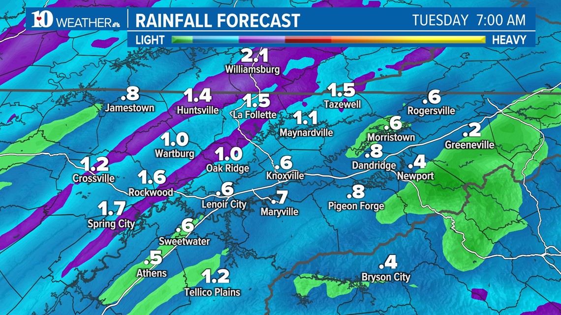
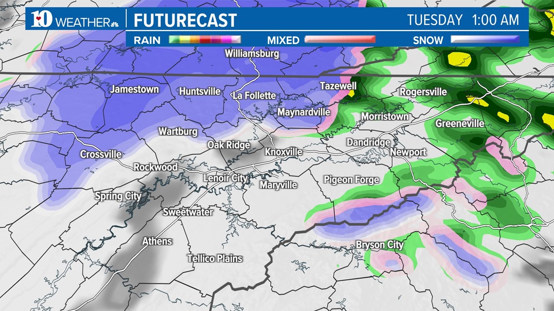
Once the front moves east, moisture wrapping around the low pressure may turn to snow showers for the northern Cumberland Plateau as well as higher elevations in the northern Smokies. Little if any accumulation is anticipated but snow may accumulate in central Tennessee.

The wind will also increase behind the front as it passes. Gusts may be between 20 to 30 miles per hour before subsiding late Tuesday.
Thereafter, high pressure will be building into Tennessee for the rest of the week which means a few days of sunshine and dry conditions. Temps will be falling behind the front a bit for Tuesday & Wednesday but warm back to near 60° until our next system moves in with clouds and a chance for rain Saturday.

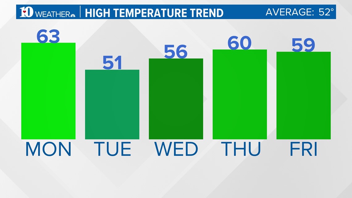
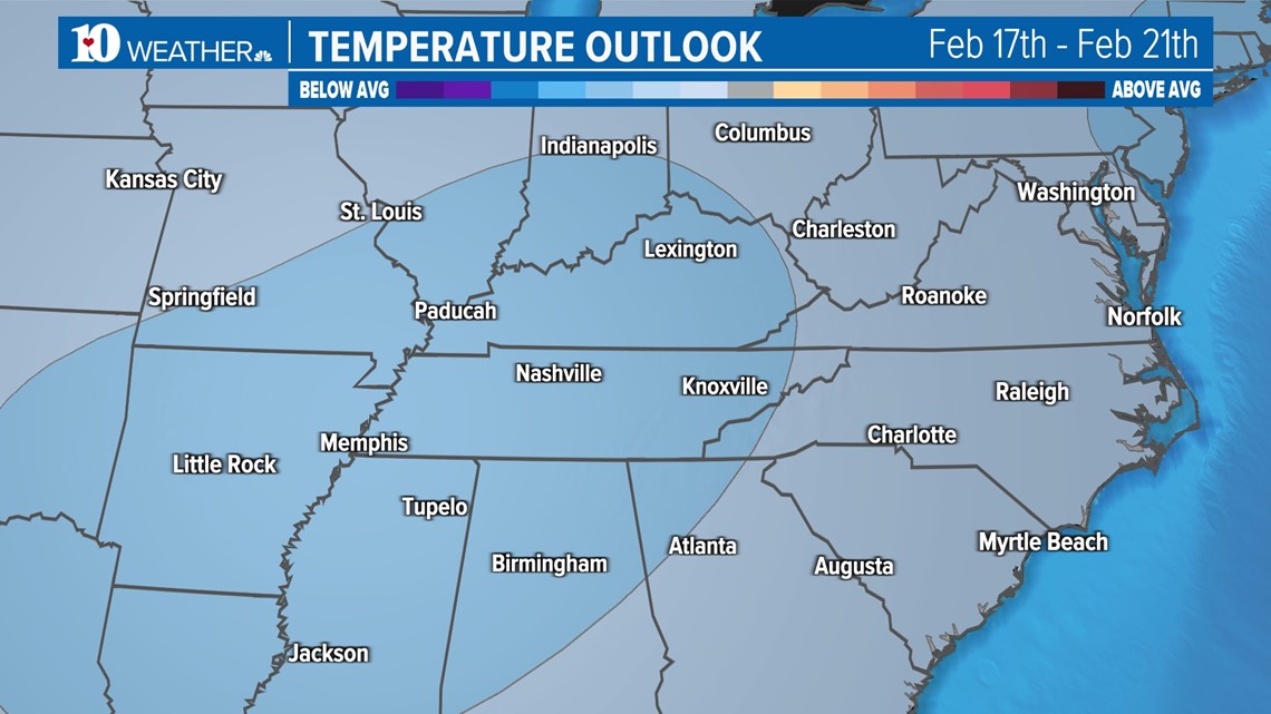
Lastly, temps are expected to drop below normal beginning next weekend. Normal highs are running in the low 50s while normal lows are in the low 30s.

Have a wonderful week!