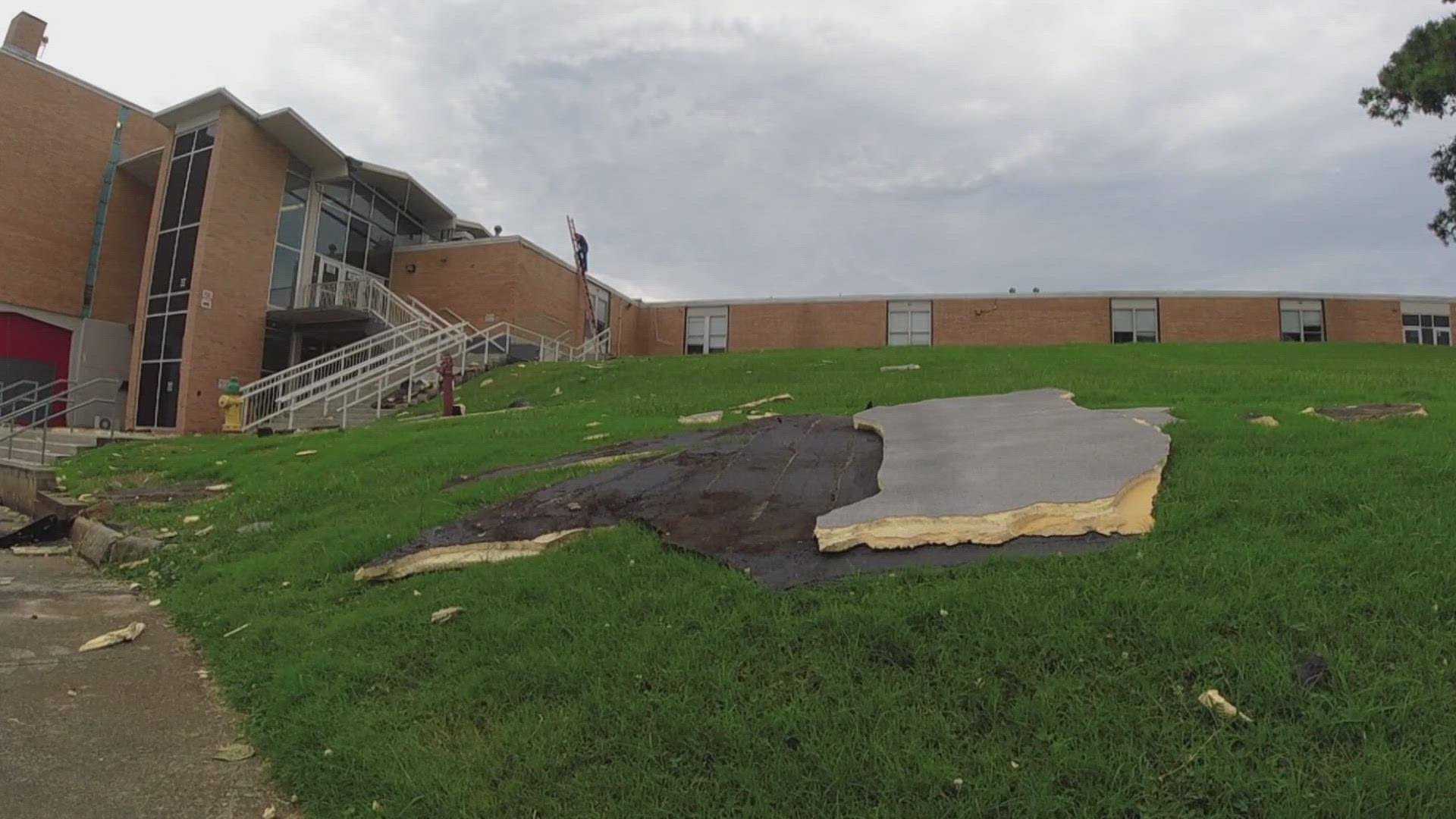
LOUDON COUNTY, Tenn. — The National Weather Service in Morristown said a tornado did not touch down in Loudon County on Monday, during severe storms that damaged a high school, knocked out power and toppled trees.
The storms blew parts of Loudon High School's roof off, giving students a day off. It would have been their fourth day back in class. According to an NWS preliminary report, a line of thunderstorms produced "extensive wind damage," especially from the high school and east-northeast toward Highway 321 South at Antioch.
They said winds were estimated to reach 75 mph and started at around 2:02 p.m. They said the peak wind ended at around 2:10 p.m. and broke tree branches of up to three inches in diameter. It also said the fire station at Antioch Church Rd. saw damage to one of their garage doors.
The NWS said "bow echoes" caused most of the damage. They said the term is based on how bands of rain showers or thunderstorms "bow out" when the storm's strong winds reach the surface and start spreading horizontally.
Bow echoes usually come from a cluster of storms, but can also begin from a single supercell thunderstorm. As downdrafts cooled by rain reach the ground, they spread horizontally — marking the start of a thunderstorm cell dissipating.
Cooler, denser air then starts hugging the surface and spreading horizontally, forcing lighter and warmer air back up into the atmosphere. The boundary between the cooler air and the warmer air is called a "gust front," according to the NWS.
The air forced up by a gust front then starts the formation of a new thunderstorm cell, which then creates more rain-cooled air, allowing the gust front to maintain its strength.
The "bowing out" happens as air starts flowing in on the trailing side of the thunderstorm, causing an updraft that tilts toward the trailing edge. Since the updraft tilts the edge of the thunderstorm, cumulonimbus clouds can expand further. This helps increase the aerial coverage of rain and then adds more cool air to the thunderstorm, further strengthening the gust front and causing it to "bow out."
The process then repeats, creating stronger and stronger gust fronts with an area of moderate-to-occasionally-heavy rain near the center of the cold pool, behind the gust front. Along the leading edge of the bow echo, thunderstorms can start producing downbursts and microbursts.
If a bow echo progresses more than 250 miles with wind gusts of 58 mph or greater, then the bow echo is classified as a derecho, according to the NWS.

