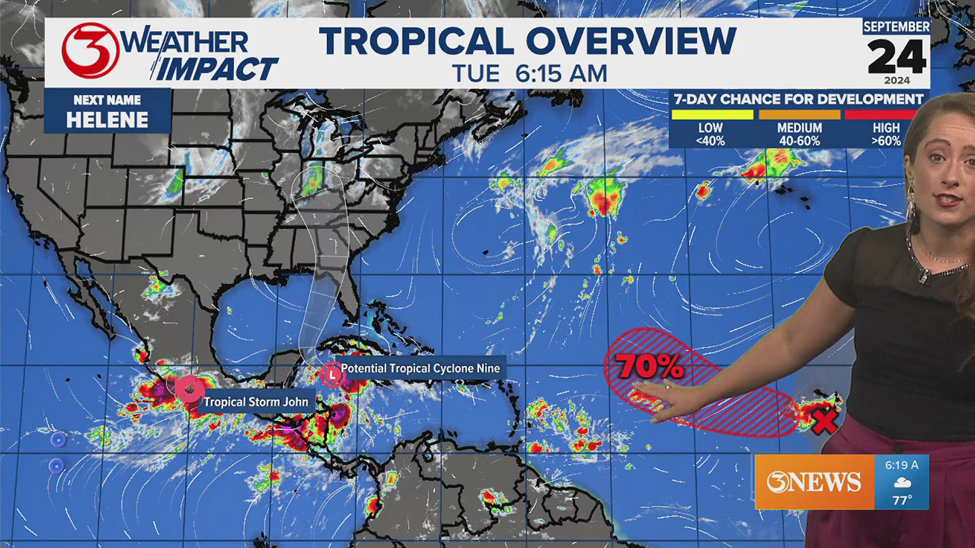
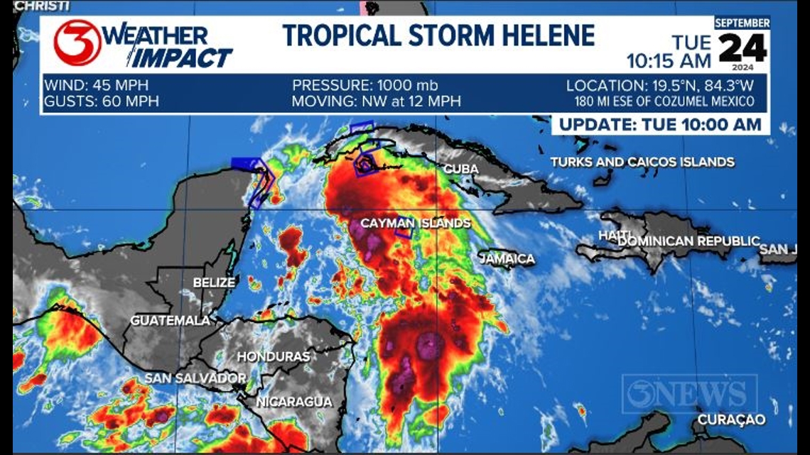
CORPUS CHRISTI, Texas — Potential Tropical Cyclone Nine is now Tropical Storm Helene and is expected to continue to intensify to near hurricane strength by Wednesday.

Intensification will only continue over the Eastern Gulf of Mexico. A Major Category 3 Hurricane is likely at Landfall near the Big Bend region of Florida.

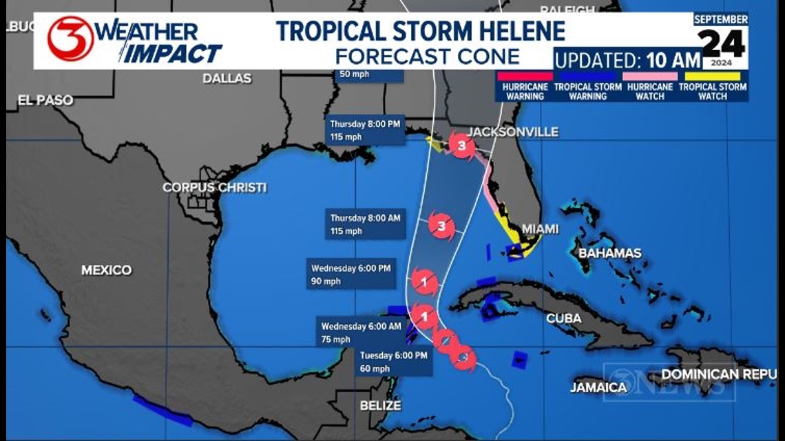
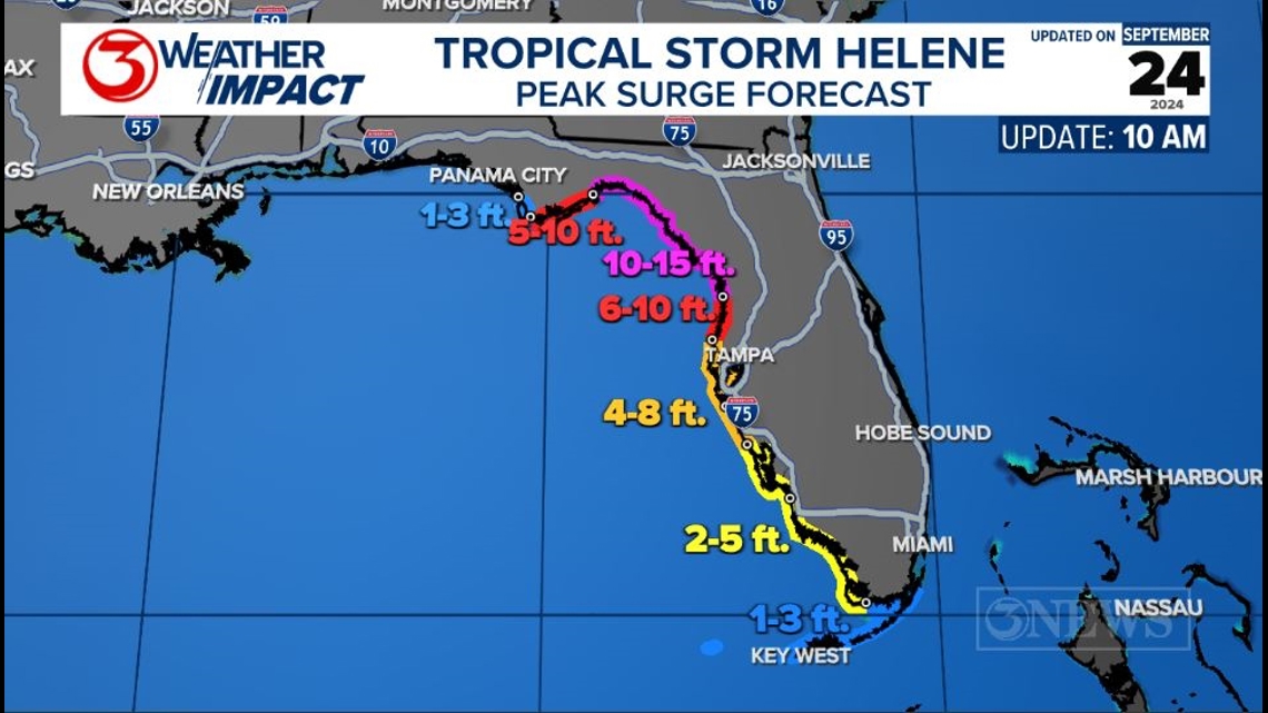
Life-threatening storm surge is expected anywhere along the Gulf Coast of Florida. Areas on the east side of the storm and closest to the eye at landfall should anticipate 10-15 ft of inundation. Remember the right front quadrant of the storm as it is approaching land is where the highest surge and strong winds will be. At Cat 3 115 mph sustained winds are anticipated at landfall.

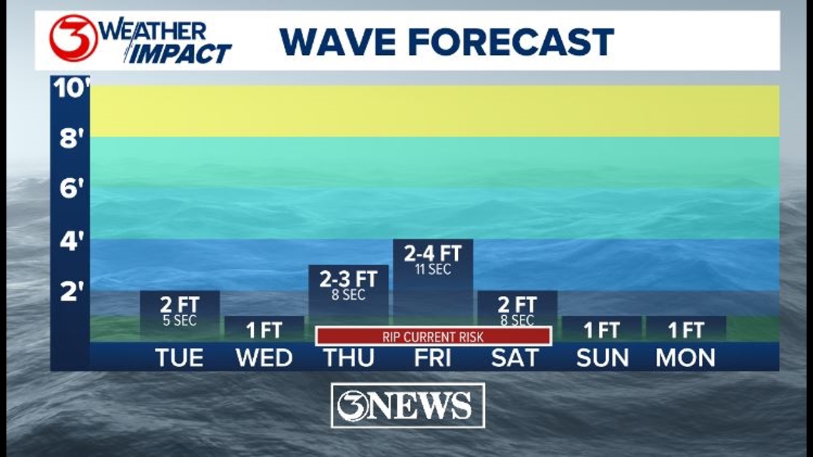
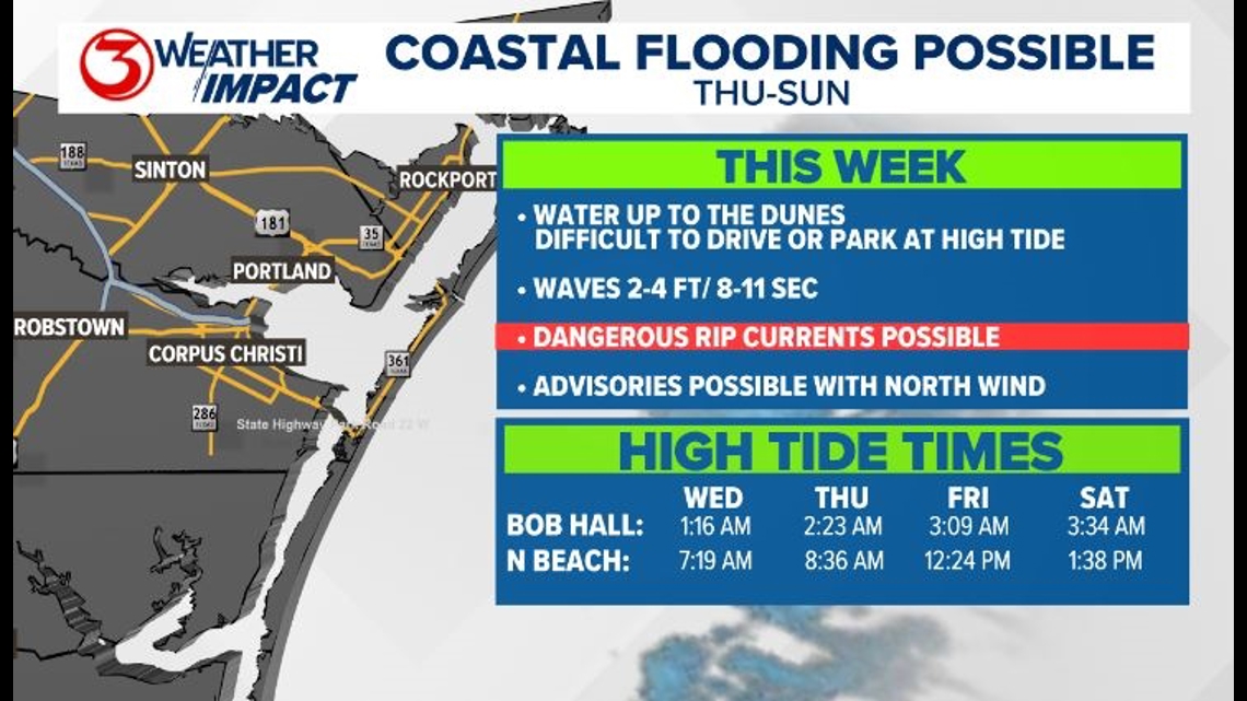
Once in the Gulf, this will send swells rippling toward the Texas Coast, and our rip current risk will increase. Minor coastal flooding will also be possible thanks to the north wind and the longer period of swells.

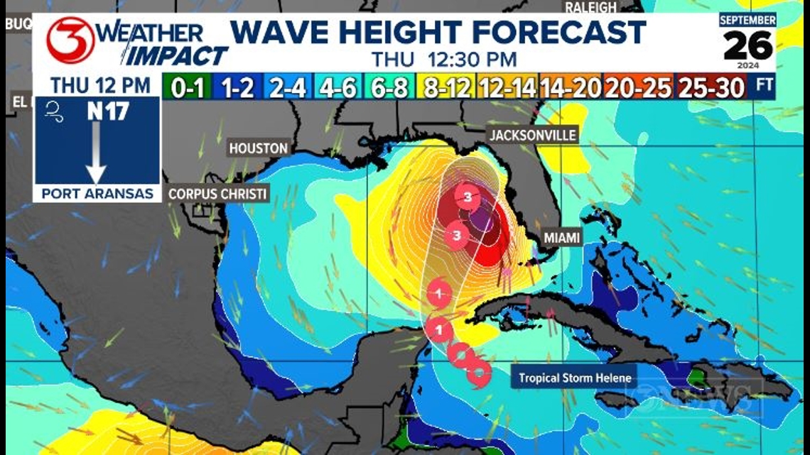
The most dangerous seas will be in the Eastern Gulf of Mexico with wave heights up to 20 ft. Along the Texas Coast, expect 2-4 ft waves with an 8-11 second period Thursday through Saturday. This will increase the rip current risk and make conditions along the Texas Coast hazardous for swimming. We have Weather Impact Alerts up for this hazard. There may be some minor coastal flooding on Thursday and Friday. too.

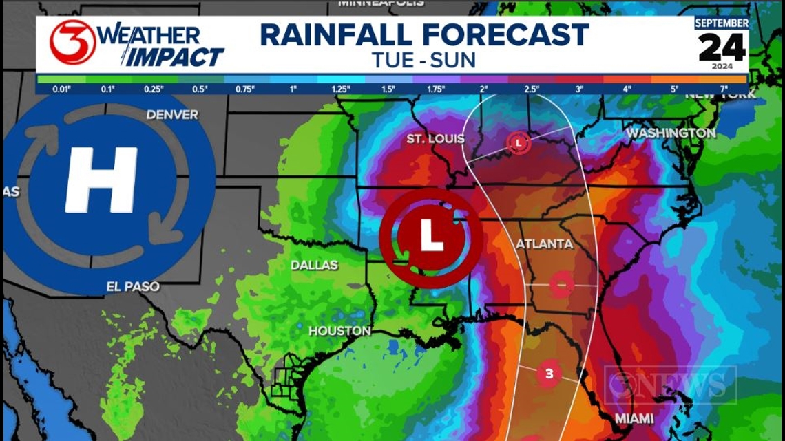
The forecast calls for Category 3 Hurricane strength before landfall along the Big Bend region of Florida. This storm is forecast to bring 10-15 ft of storm surge along the Gulf Coast of Florida, and heavy rainfall well inland as it tracks north.

Interests in Florida should prepare for a Major Hurricane. Local areas along the Texas Coast should monitor tide forecasts. Here is a look at high tide times for Bob Hall Pier and North Beach.

---------------------------------------------------------------
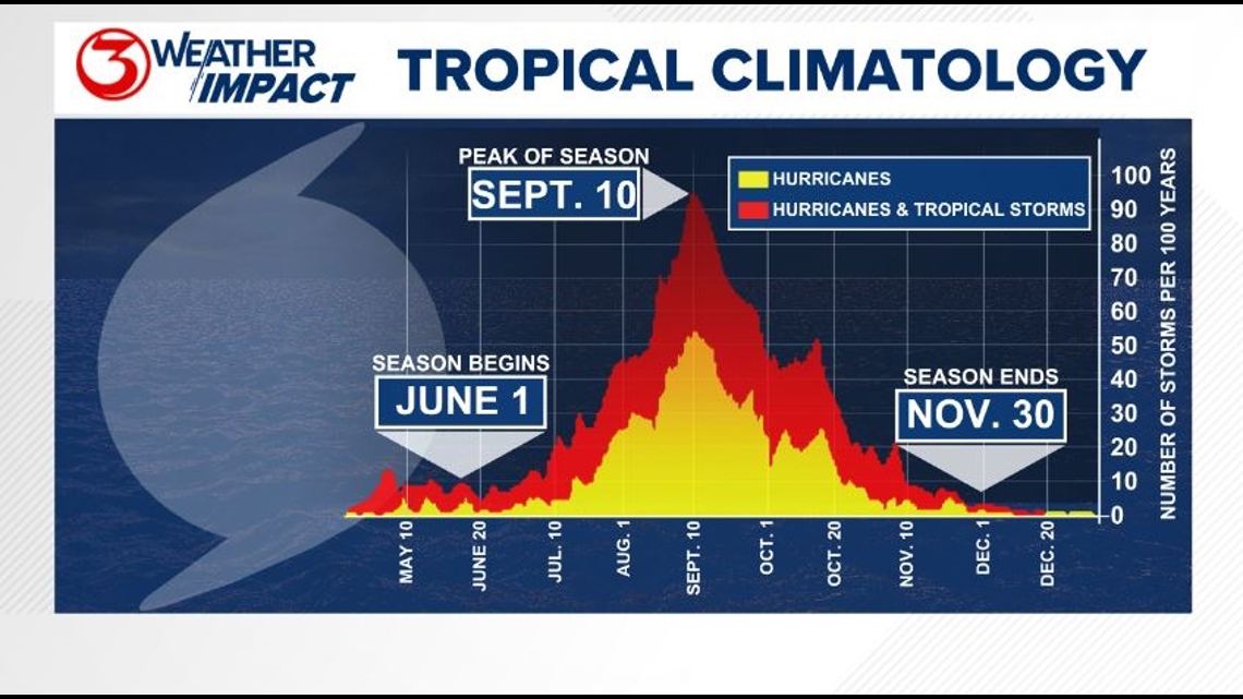
The Atlantic Hurricane Season runs from June 1 to November 30, with the peak of the climatological peak of the season happening on September 10.

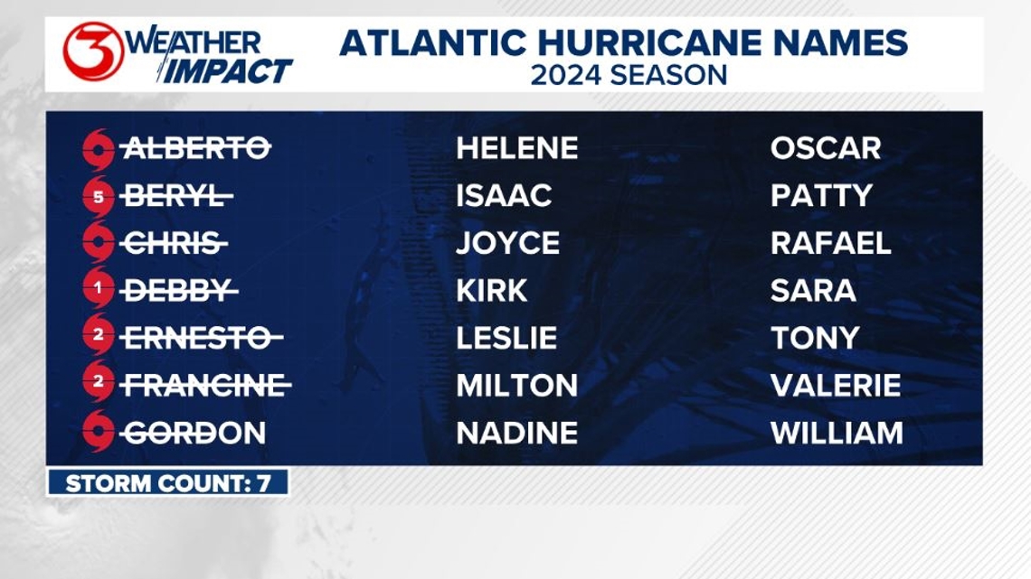
Here are the names for the 2024 Atlantic Hurricane Season. Names are given to tropical cyclones (tropical storms and hurricanes).

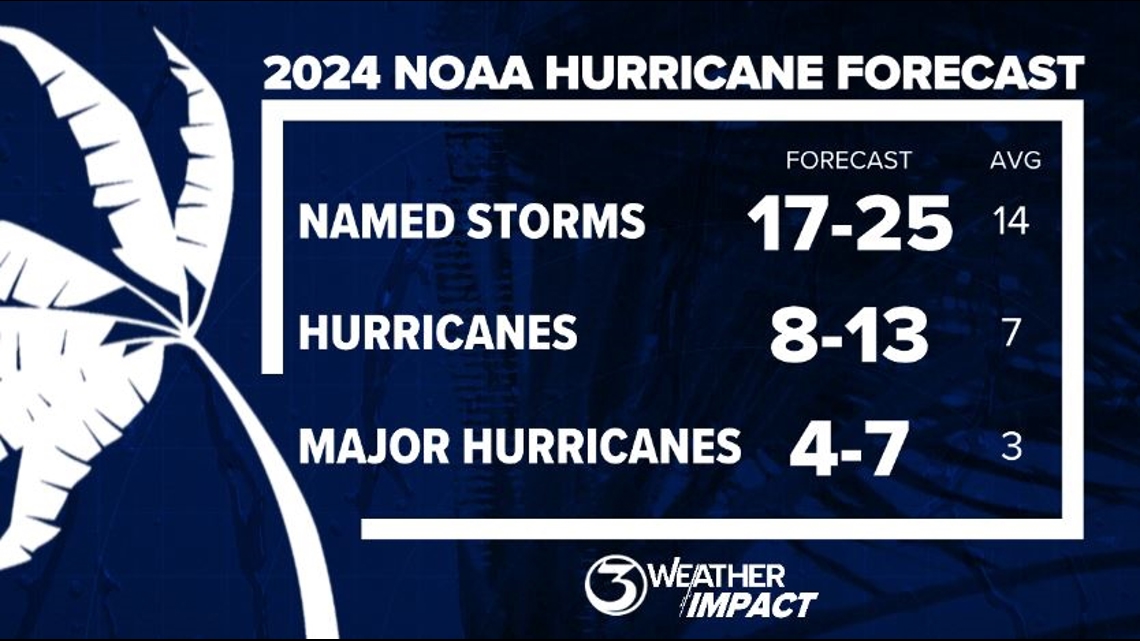
On May 23, NOAA released their forecast for the 2024 Atlantic Hurricane Season. They're predicting an above-average year, with 17-25 named storms. This is the highest pre-season forecast they've ever issued.
The high number of storms forecast is due to near-record sea surface temperatures and the return of La Nina, both of which favor tropical cyclone development. We talk more about those in our Hurricane Special, which you can watch here!

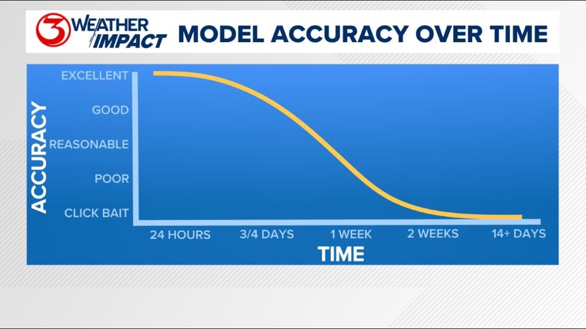
Remember to not "anchor" to the first forecast you see - forecasts change. Also, rely on a credible source for your tropical information and forecasts.