WASHINGTON COUNTY, Tenn. — Communities in upper East Tennessee are still recovering from the devastation brought by Hurricane Helene, a process that's expected to take months at least. When the storm hit, it washed away homes and put entire towns underwater. Bridges were swept away as the Nolichucky River, among others, swelled to historic heights.
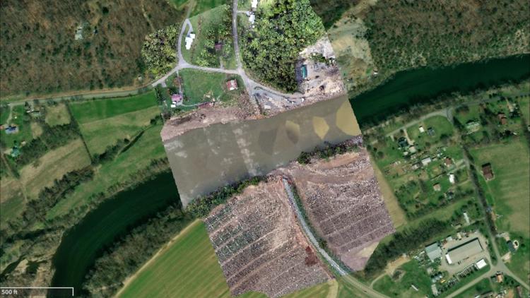
East Tennessee State University put together a tool to help people visualize the damage from the storm. The university took aerial photos of Washington County before the storm and overlaid more recent aerial photos that revealed the extent of damage from the Nolichucky River's surge.
Where there were bridges, the recent aerial photos show roads leading into a river. The new images also show plots of land where there were once homes, as well as piles of debris left in previously lush fields.
The tool has before-and-after images of Snapp Bridge, Bumpus Cove, Little Germany, Elliott Bridge and several other locations in the county.
The university also published a website that offers detailed explorations of the impact of Hurricane Helene, including data about rainfall and river flow analyses.


