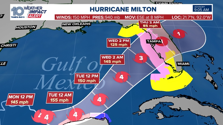
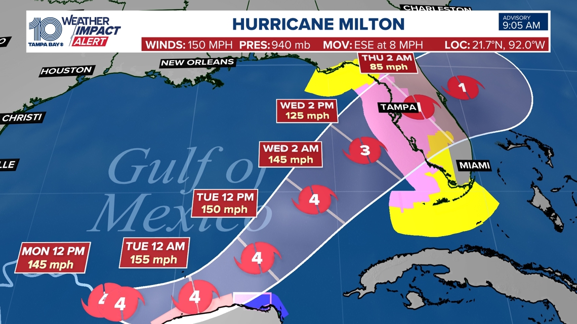
TAMPA, Fla. — Hurricane Milton continues to "rapidly intensify" as it continues its track toward Florida and is now a major Category 4 storm, according to national hurricane forecasters.
Milton came on the scene on Saturday as a tropical storm. Now, as a Category 4 hurricane, the storm is a major hurricane, the National Hurricane Center said.
Florida could see impacts beginning Tuesday evening into Wednesday.
As of the latest advisory, the storm is about 735 miles west-southwest of Tampa with maximum sustained winds at 150 mph. It is moving east-southeast at 8 mph.
"Further strengthening is expected, and Milton is forecast to become an extremely dangerous category 4 hurricane later today and maintain that intensity for the next couple of days," the NHC said.

A hurricane watch has been issued for the following:
- Coast of the Yucatan Peninsula of Mexico from Rio Lagartos to Cabo Catoche
- Florida Gulf coast from Chokoloskee to the mouth of the Suwanee River, including Tampa Bay
- Dry Tortugas
A tropical storm warning is in place from east of Cabo Catoche to Cancun.
A tropical storm watch is in effect for the following:
- Florida Gulf coast from Flamingo to south of Chokoloskee
- Florida Gulf coast north of the mouth of the Suwanee River to Indian Pass
- Lower, Middle, and Upper Florida Keys, including Florida Bay
A storm surge watch has been issued for the following:
- The Florida Gulf coast from Flamingo northward to the Suwannee River, including Charlotte Harbor and Tampa Bay.
Hurricane and storm surge watches have been issued for portions of Florida, including Tampa Bay.
Currently, the Tampa Bay area is expected to see between 8 to 12 feet of storm surge.
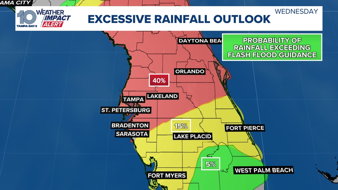
Rainfall from Milton is expected to range between 5-10 inches with localized totals up to 12 inches across portions of the Florida Peninsula and the Keys through Wednesday night. That rainfall will bring risks of flash, urban and areal flooding along with minor to moderate river flooding, according to NHC. A Flash Flood Watch is in effect for the Florida Peninsula starting Sunday morning.
With a front sinking in from the north, the areas prone to seeing most of the rain will exist along and south of I-4. Coastal areas should pay close attention to the forecast and have a way to receive alerts in case a flash flood warning were to be issued. Anticipated rainfall from Sunday night to Wednesday will range from 3" - 6" with higher totals possible in isolated spots.

By Wednesday, Hurricane Milton's impacts will also include storm surge and damaging winds. Keep checking back for updates.
Our 10 Tampa Bay Weather team will continue to monitor any development and keep you informed, prepared and connected through the rest of hurricane season.