KNOXVILLE, Tenn. — January 2024 has been a busy month weather-wise, and we aren't done yet.
After damaging winds during the second week and record-setting wintry weather last week, now we are talking about heavy rain moving into East Tennessee.
An area of low pressure to our west and an area of high pressure to the east will create southwesterly winds, pulling abundant moisture northward from the Gulf of Mexico.
Now that temperatures are warming up, melting snow and ice have saturated the ground.
This means that we will have more runoff than usual when the rain arrives since it can't soak into the ground.
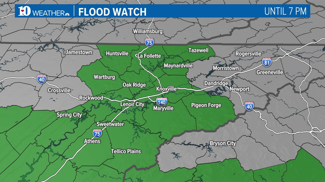
A Flood Watch has been issued for the counties shaded in green through tonight. Flooding is also possible outside of these areas.


The heaviest and most widespread rainfall is expected through the day today.
Rivers, creeks and streams may rise quickly, and standing water in low-lying and poor drainage areas is possible.
Mudslides may also become a concern as the soils become even more saturated from the heavy rain.
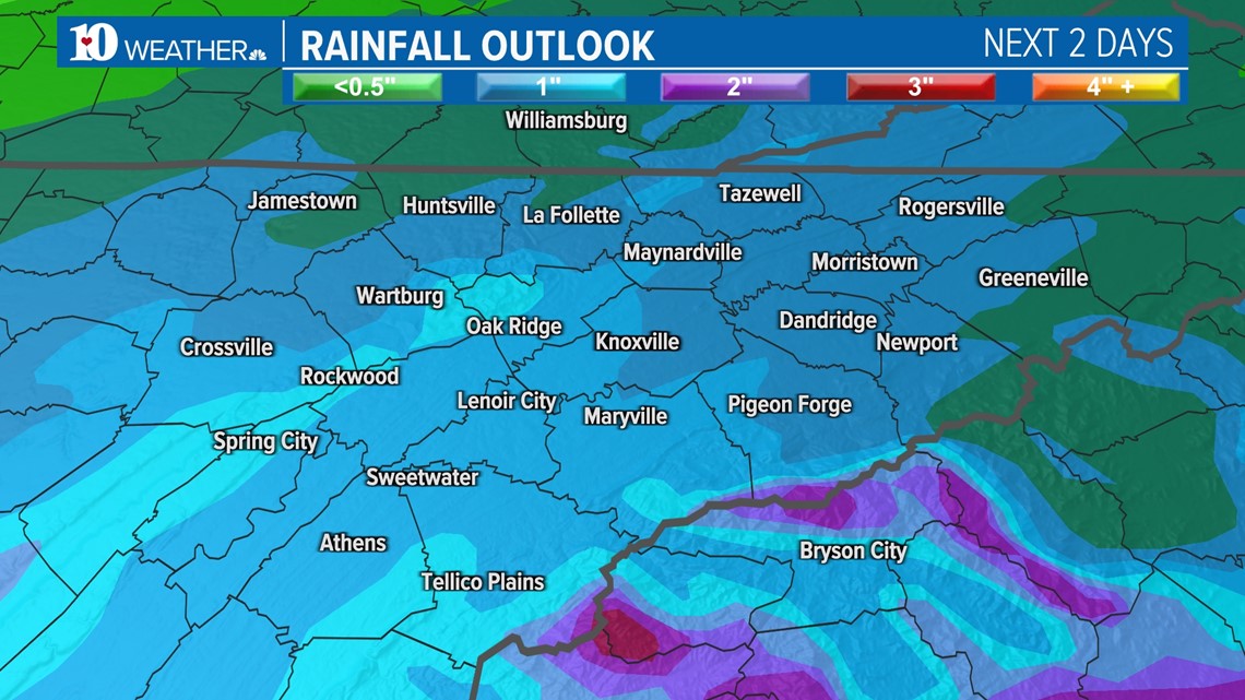
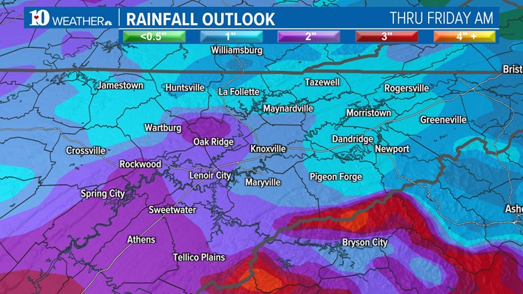
Between an inch and 3 inches of rain is possible between now and Friday morning, with higher totals possible in the Southern and Central Valley and on the Plateau.


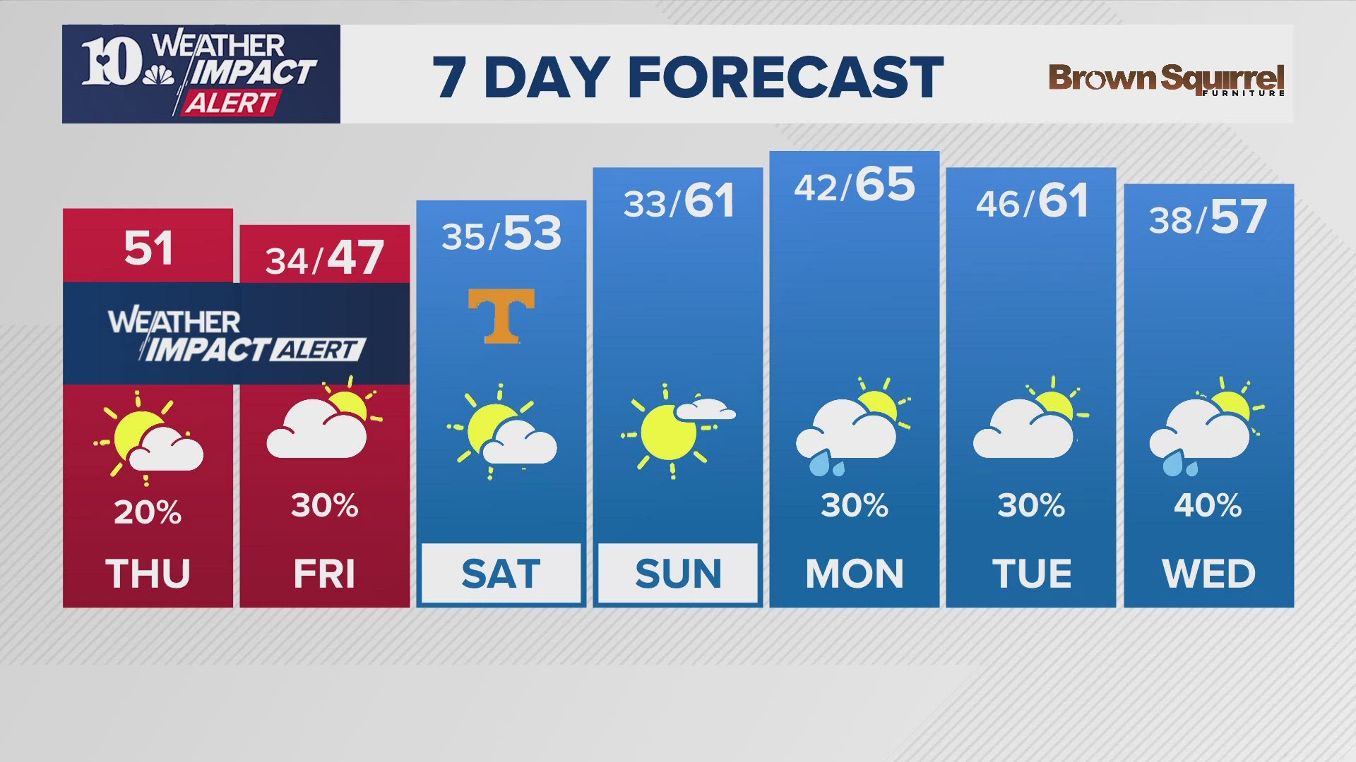
As of now, it looks like we'll have a break in the heavier showers on Friday with only spotty rain chances before another wave of energy moves through the area on Saturday and Sunday.
The potential for flooding this weekend will depend on how much rainfall we see tomorrow so check back for updates!


