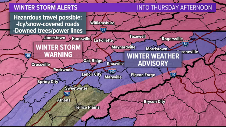
An area of low pressure will lift north across the region and bring a mix of snow, sleet, freezing rain and rain to East Tennessee and Southeast Kentucky.
Because the air and ground are already cold, the precipitation will START as snow tonight for the Plateau, then transition to a wintry mix before changing to all rain Thursday morning.
So this is a little different than our typical systems.... the wintry weather comes first.
Let's go region by region...
**A Winter Storm Warning and Winter Weather Advisory have been issued for overnight into Thursday morning. Hazardous road conditions are possible so travel is not recommended. Stay home if you can!**


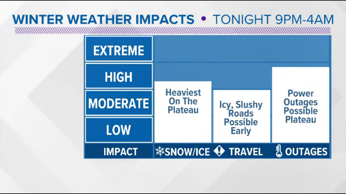
PLATEAU: Snow will spread in from the southwest this evening. Snowfall rates could be heavy until about 3 a.m., then a transition to a wintry mix of sleet, freezing rain and rain will begin. This will changeover will work it's way north so that the Plateau should be mostly rain by around 5 a.m.... But because the ground is so cold and Arctic air can be really stubborn and hard to erode, we may continue to see that wintry mix until the precipitation tapers off Thursday morning.
Snow/sleet totals could be as high as 3"-5" in northern areas, with 1"-4" possible closer to I-40. This may partially melt if we see that changeover to rain but roads are expected to be very slushy and slick.
Additional freezing rain accumulations of up to 0.1" are possible and the combination of heavy snow and ice could cause more trees to come down causing additional power outages and making roads hazardous. Avoid travel if possible overnight through midday Thursday.

Coverage of the precipitation should become less widespread through the morning but some showers are expected to last into the afternoon before transitioning back to light snow Thursday evening.

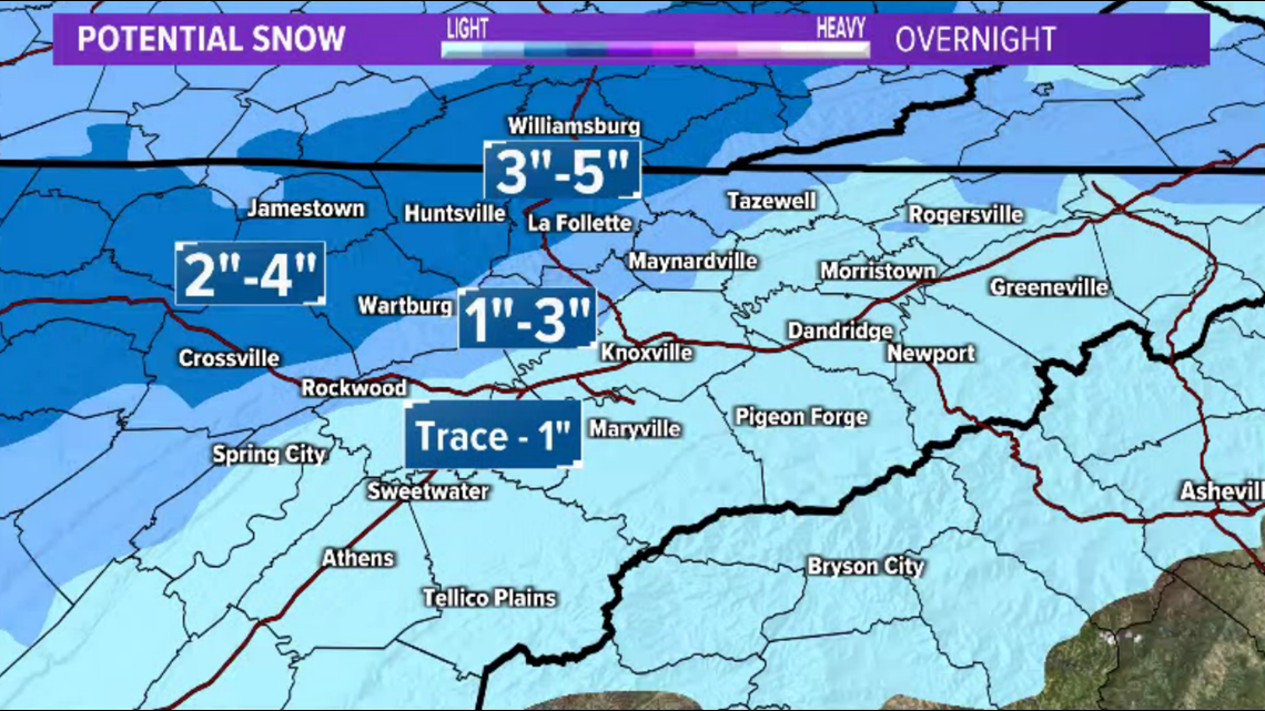
VALLEY: A wintry mix of rain, sleet and snow will be possible at the onset of precipitation late tonight and we could see a temporary accumulation of snow/sleet in the Valley. A trace to 1" is possible. A transition to all rain will quickly melt any accumulations and the Valley overnight so we should have rain for the Thursday morning commute.
Heavy rain could cause localized flooding so slow down and use extra caution on the roads!
Scattered showers will continue off and on throughout the day with a transition to flurries possible late Thursday evening.
FOOTHILLS/MOUNTAINS: Precipitation will begin overnight and this event isn't going to be about the snow... We might have light accumulations to start but the bigger concern will be the potential for freezing rain.
Ice accumulations 0.01"-0.1" (with isolated higher amounts) will be possible. This could make roads slicks and bring down a few trees/power lines. Avoid travel overnight and early Thursday morning if possible.

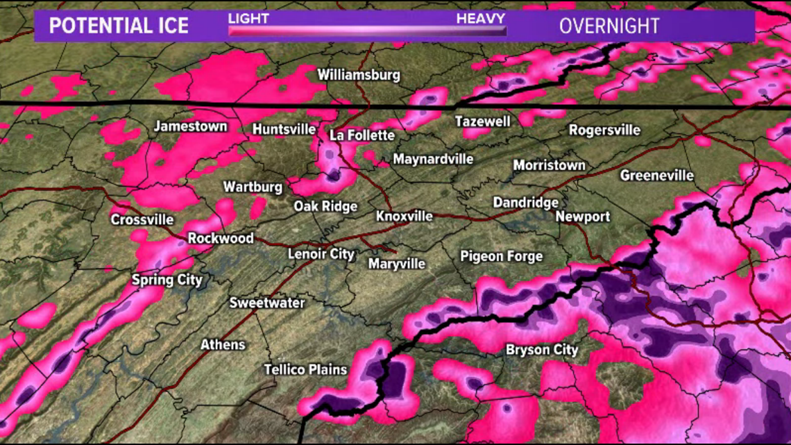
The wintry mix will transition over to all rain early Thursday morning. Heavy rain may cause localized flooding and rivers, creeks and streams may rise quickly. Pay attention to water levels in your area.
Scattered showers will continue off and on throughout the day with a transition to flurries possible late Thursday evening.
SUMMARY: This is a tricky forecast and a messy weather system. Check back for updates and be safe tonight!

