

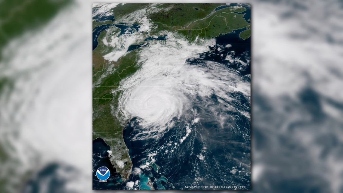
Knoxville — Florence made landfall at Wrightsville Beach, North Carolina, early Friday morning as a category 1 hurricane with maximum sustained winds of 90 miles per hour. But don't be fooled by the landfall and slow weakening, the impacts from Florence are far from over, particularly for coastal regions in the Carolinas facing major flooding.

Forecast: wbir.com/weather
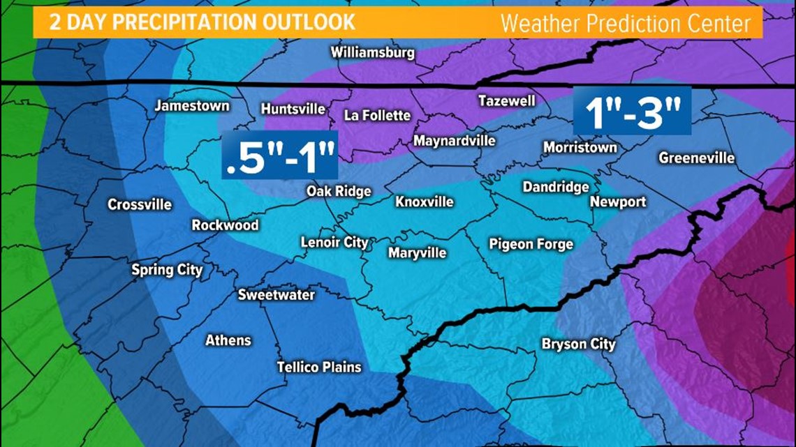
Here in East Tennessee, rainfall totals will generally be around 1-3" from Sunday through Monday, with higher totals possible in the higher elevations of the Smokies, Upper East Tennessee and Southwest Virginia.

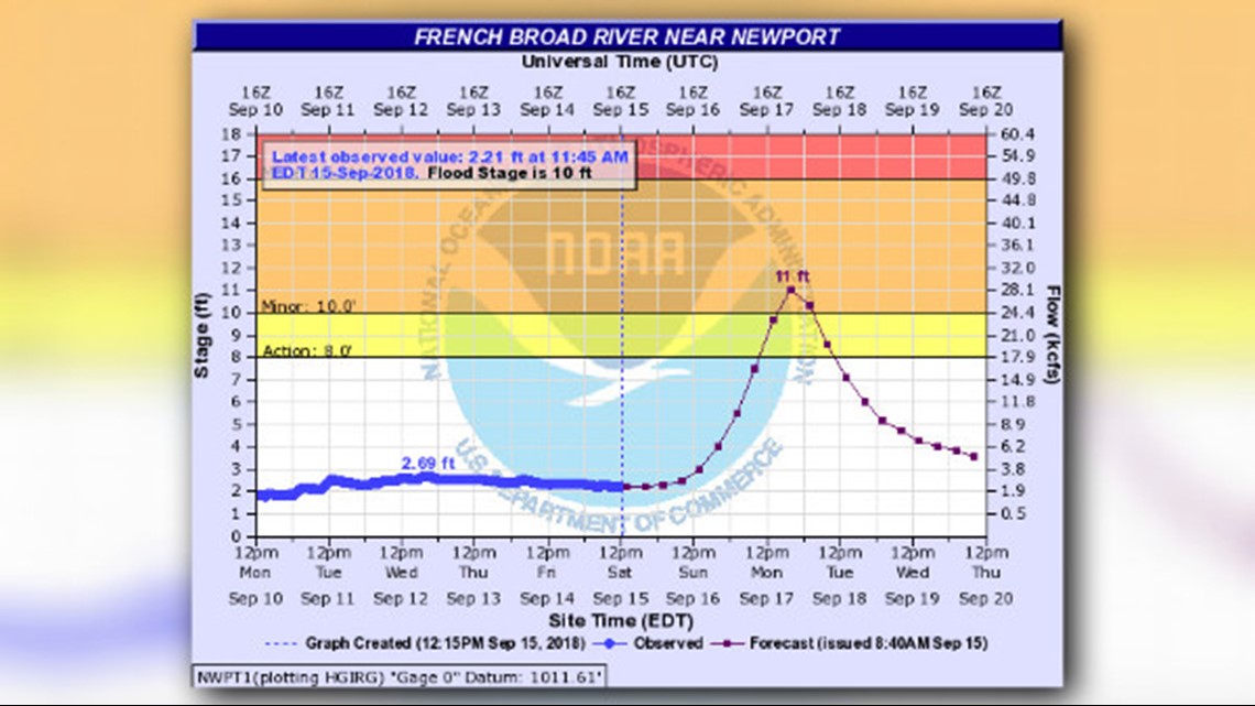
Rivers with headwaters in Western North Carolina may rise and eventually reach flood stage early next week in East Tennessee.
Residents that live along the French Broad, Pigeon, Hiwassee, Little Tennessee, Nolichucky and Little Pigeon River should keep an eye on water levels.
**A Flood Warning will be in effect for the French Broad River in Cocke and Jefferson Counties from Monday afternoon through Tuesday morning.**
Monday: Winds will gradually die down and be out of the southwest at 5-10 mph with lingering showers as the remnants of Florence move away from our area. Highs will be in the upper 70s.
Tuesday: The remnants of Florence should moving away from Tennessee but a few showers may linger. Otherwise, partly sunny with highs will be in the middle 80s.