
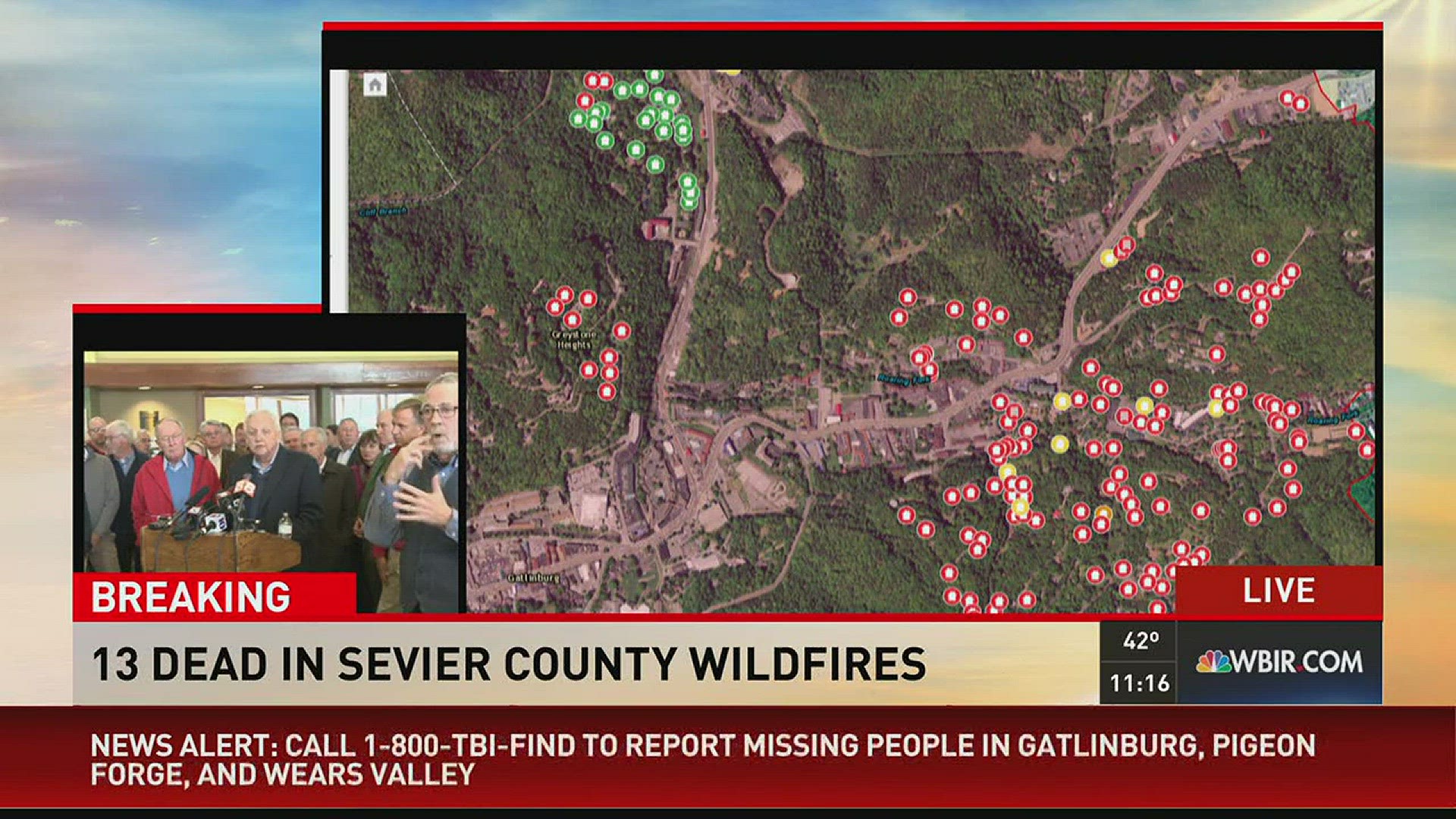
A new interactive map shows the areas inside the perimeter of the Chimney Tops 2 Fire in Gatlinburg and the Great Smoky Mountains National Park.
The fire forced more than 14,000 people to evacuate the city Monday night into Tuesday morning.
Many home and business owners still don't know what's left of their property.
The interactive map shows updated info of the structures inside the fire perimeter. Viewers can click to see if their homes or businesses are intact, damaged or destroyed. Viewers can click the plus button in the top left of the map if they can't see the markers.
The map has also color coordinated its markers. Here's what the colored markers mean:
· Green means the structure is affected
· Yellow means the structure has minor damage
· Orange means the structure has major damage
· Red means the structure was destroyed
There's also an option to search areas by different zones, including Gatlinburg, Cobbly Nob, Pigeon Forge, Wears Valley, Shell Mountain and Sevier County.
It should be noted that everything inside the footprint has not burned and officials stress that people should not assume homes or properties inside the footprint have been destroyed.
"This fire has burned in a mosaic pattern - sort of a patchwork design. Both forested areas and developed areas, including homes and businesses are within the fire perimeter, yet remain untouched by the actual fire," the website noted.
As of Thursday afternoon, officials said the Chimney Tops 2 Fire had grown to more than 17,108 acres in the Great Smoky Mountains National Park and Gatlinburg.