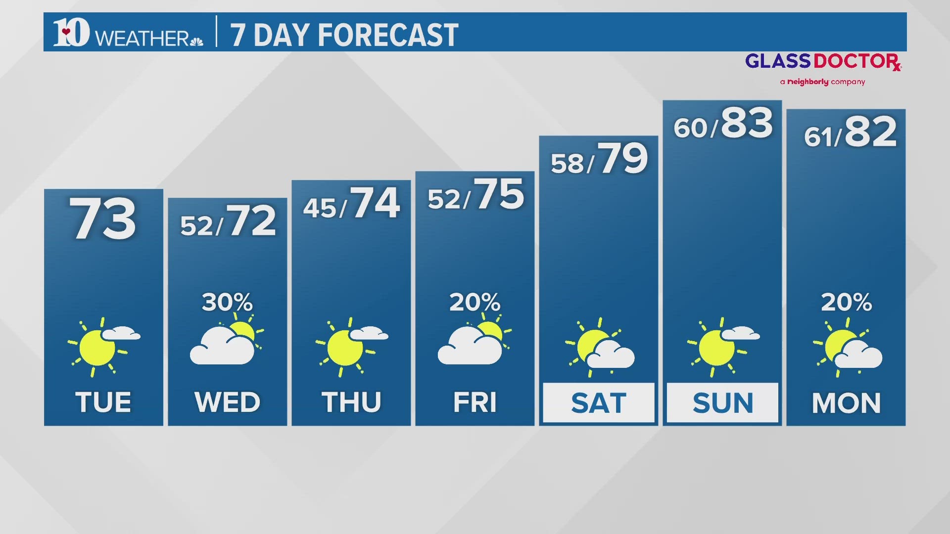
Another cold Winter's day on Wednesday....
We will transition from a cold pattern Wednesday to a much warmer one on Thursday!
MORE: Get the latest forecast
Download our free WBIR weather app with interactive radar and follow us on Facebook and Twitter
**Travel could become hazardous because of the wintry weather in the higher elevations of the Foothills and Smokies. A Winter Weather Advisory will be in effect this evening into Wednesday morning.
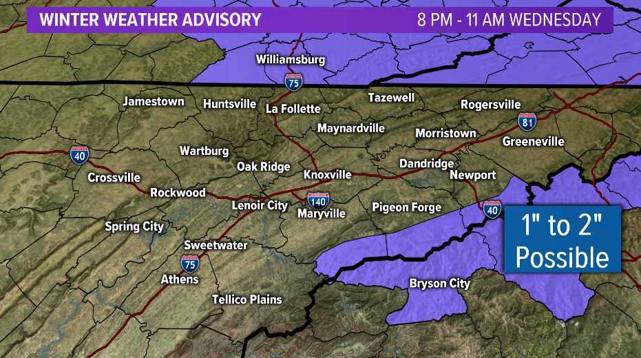
Light snow showers will develop overnight in the higher elevations with 1 to 2 inches possible through early Wednesday morning. Elsewhere, light snow flurries could produce a dusting in some spots.
Warmer weather returns for Thursday ahead of the next system that will arrive on Friday with scattered rain showers expected to develop. Check back for updates!
**************************************************************************************************
Follow us on social media!
WBIR Weather on Facebook
WBIR Weather on Twitter
Todd Howell on Twitter
Mike Witcher on Twitter
Cassie Nall on Twitter